Adam Johnson Minnesota Photography: Blog https://ajragno.zenfolio.com/blog en-us All Images (C) 2009-2020 Adam Johnson [email protected] 612-518-5445 [email protected] (Adam Johnson Minnesota Photography) Mon, 16 Mar 2020 07:06:00 GMT Mon, 16 Mar 2020 07:06:00 GMT https://ajragno.zenfolio.com/img/s/v-12/u972047940-o82296876-50.jpg Adam Johnson Minnesota Photography: Blog https://ajragno.zenfolio.com/blog 120 80 Gneiss Outcrops SNA https://ajragno.zenfolio.com/blog/2016/8/gneiss-outcrops-sna I'd driven by Gneiss Outcrops numerous times as I explored the Minnesota River Valley between Granite Falls and Redwood Falls but quite honestly the area did not look impressive from the road so I kept on driving. It was not until I got out and explored on foot the gneiss outcrops and tall grass prairie that I was able to appreciate how unique this area is compared to the more accessible areas of the Minnesota River Valley.

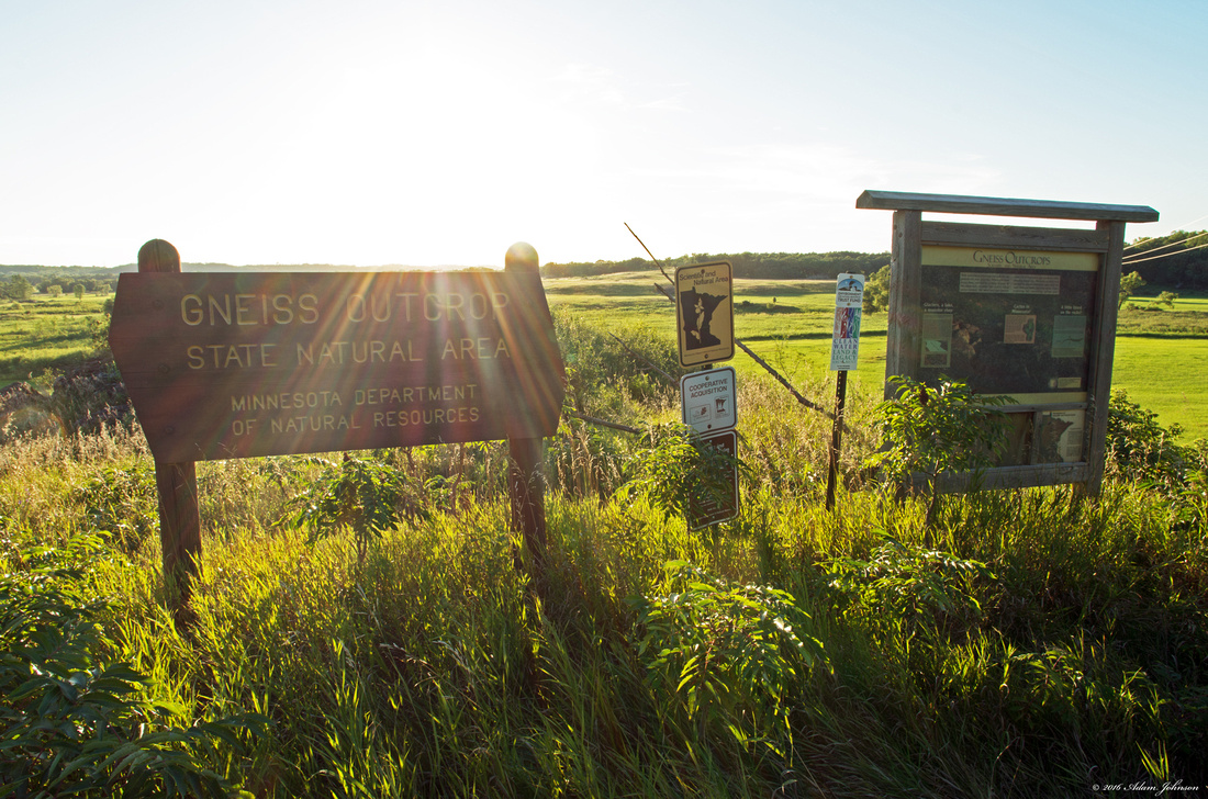
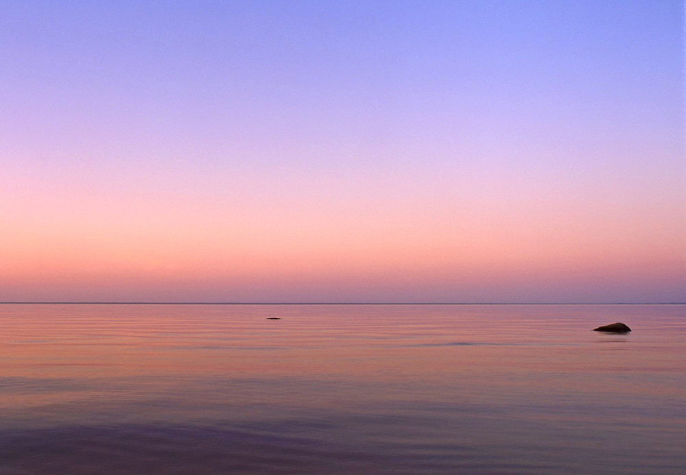
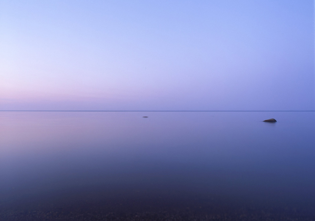
Gneiss Outcrops SNA OverlookGneiss Outcrops SNA Chippewa County

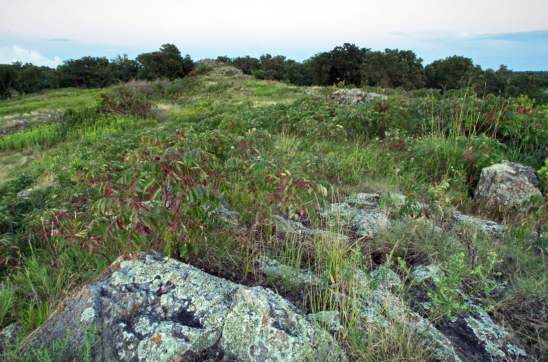
Because Gneiss Outcrops SNA has not always been public property it can be difficult to determine what is public and what is private land. There are a few barbed wire fences that appear to mark private land but are actually well within the public lands. A map and GPS would be ideal but if you can view the farm at the Northeast end of the park, public land extends approximately another 100 yards north. The land on the Southeast end of the park is more clearly marked.

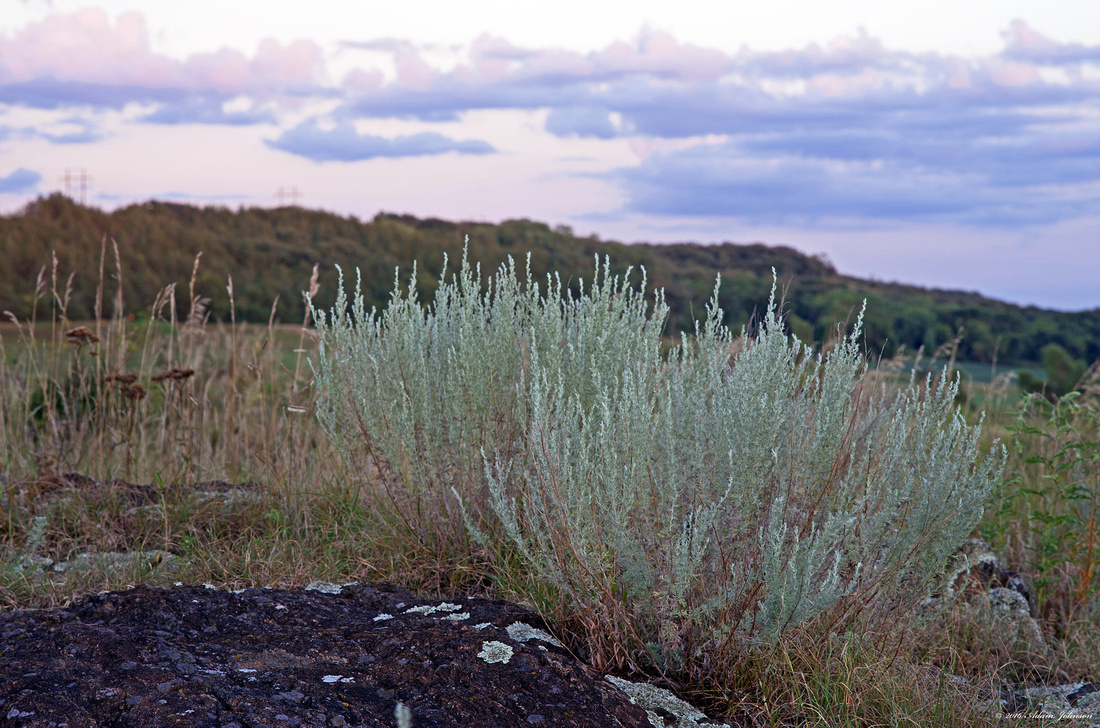
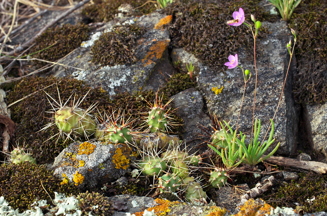
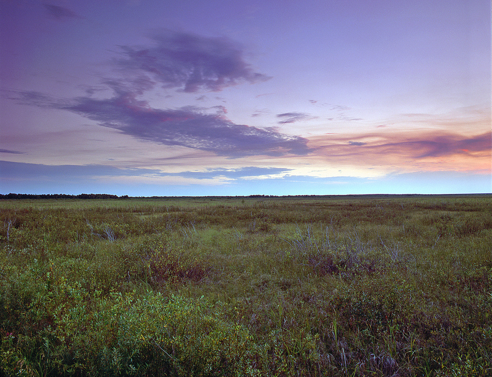
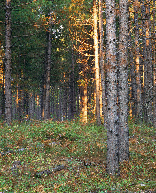
The tall grass and lack of trails make hiking difficult but this absence of human activity is also quite rewarding in that everything that lives here is surviving with minimal human influence. Wildlife is abundant and the gneiss outcrops support brittle prickly pear and plains prickly pear cacti that flower through June and July. I've also come across sagebrush, a plant I've not found elsewhere in Minnesota.

Hiking on Gneiss Outcrops
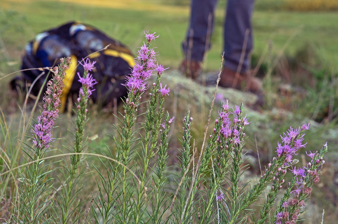
Hiking on Gneiss OutcropsGneiss Outcrops SNA

Chippewa County

Sagebrush on Gneiss Outcrops
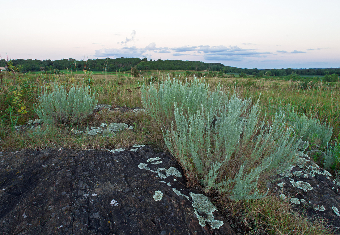
Sagebrush on Gneiss OutcropsGneiss Outcrops SNA

Chippewa County

Minnesota SagebrushMinnesota SagebrushGneiss Outcrops SNA

Chippewa County

Gneiss Outcrops SNA Prairie Grass
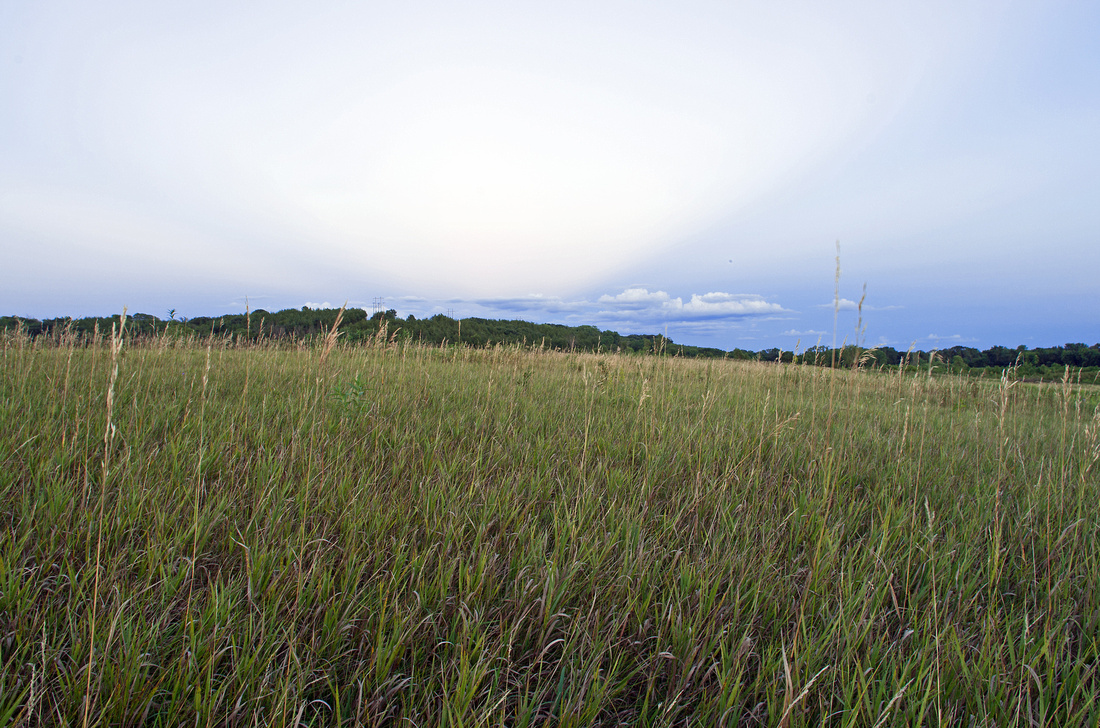
Gneiss Outcrops SNA Prairie GrassChippewa County

Flowering Prickly Pear Cactus
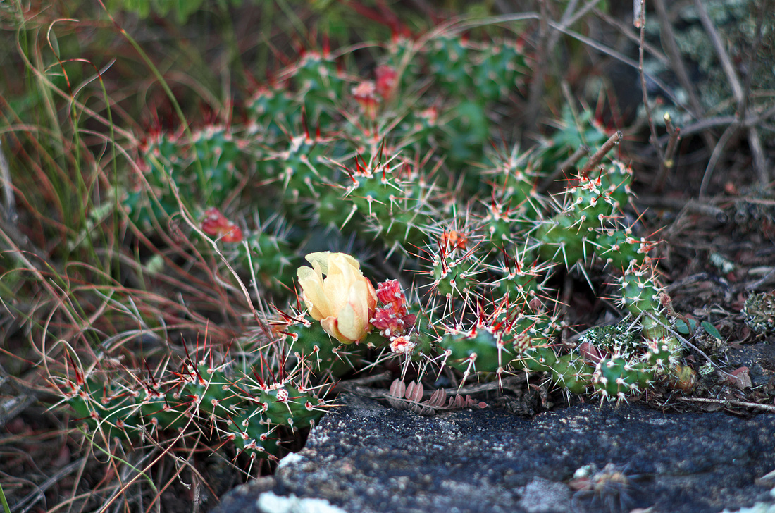
Flowering Prickly Pear CactusGneiss Outcrops SNA

Chippewa County

Plains Prickly Pear Cactus
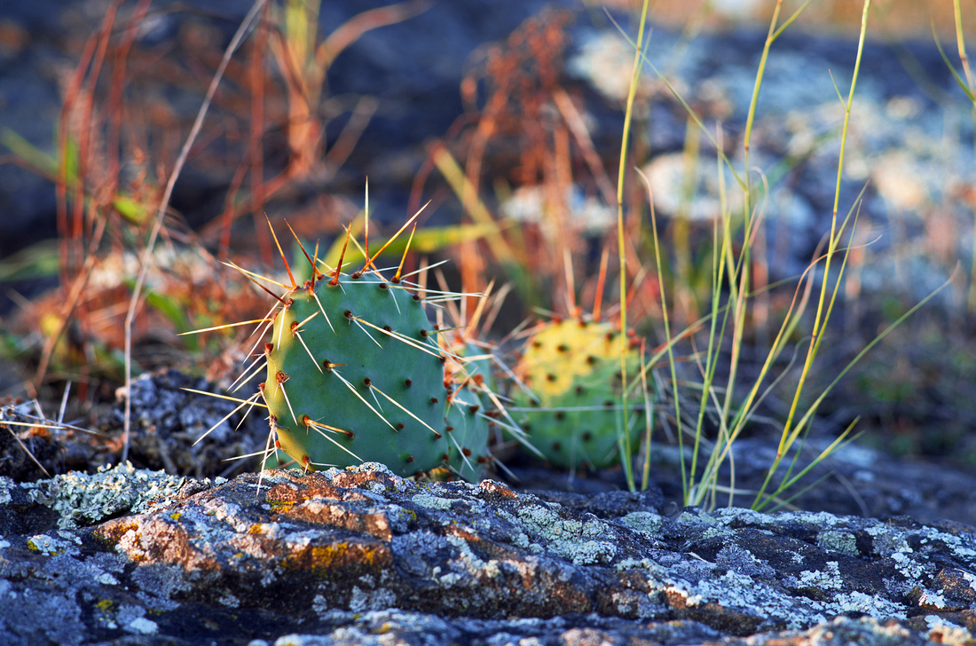
Plains Prickly Pear CactusGneiss Outcrops SNA

Chippewa County


Gneiss Outcrops at Twilight
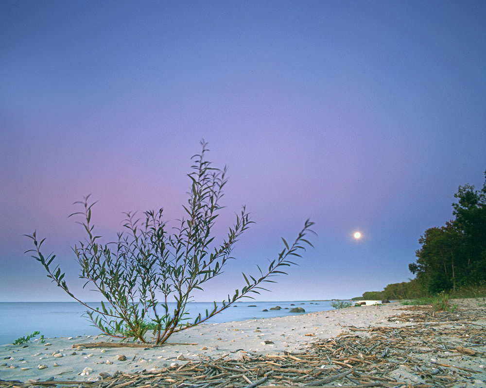
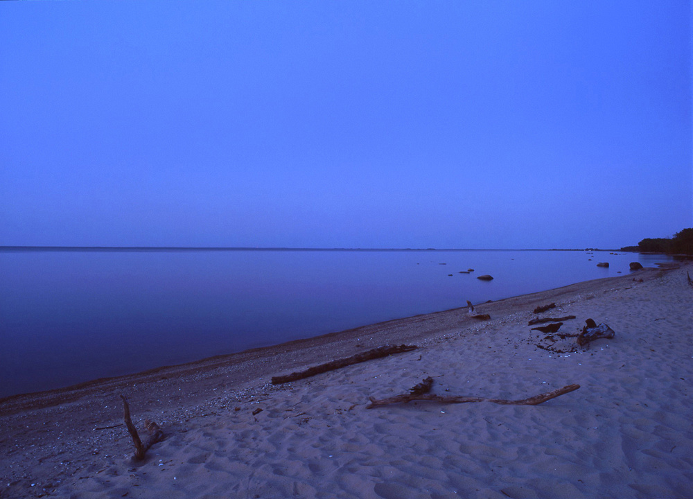
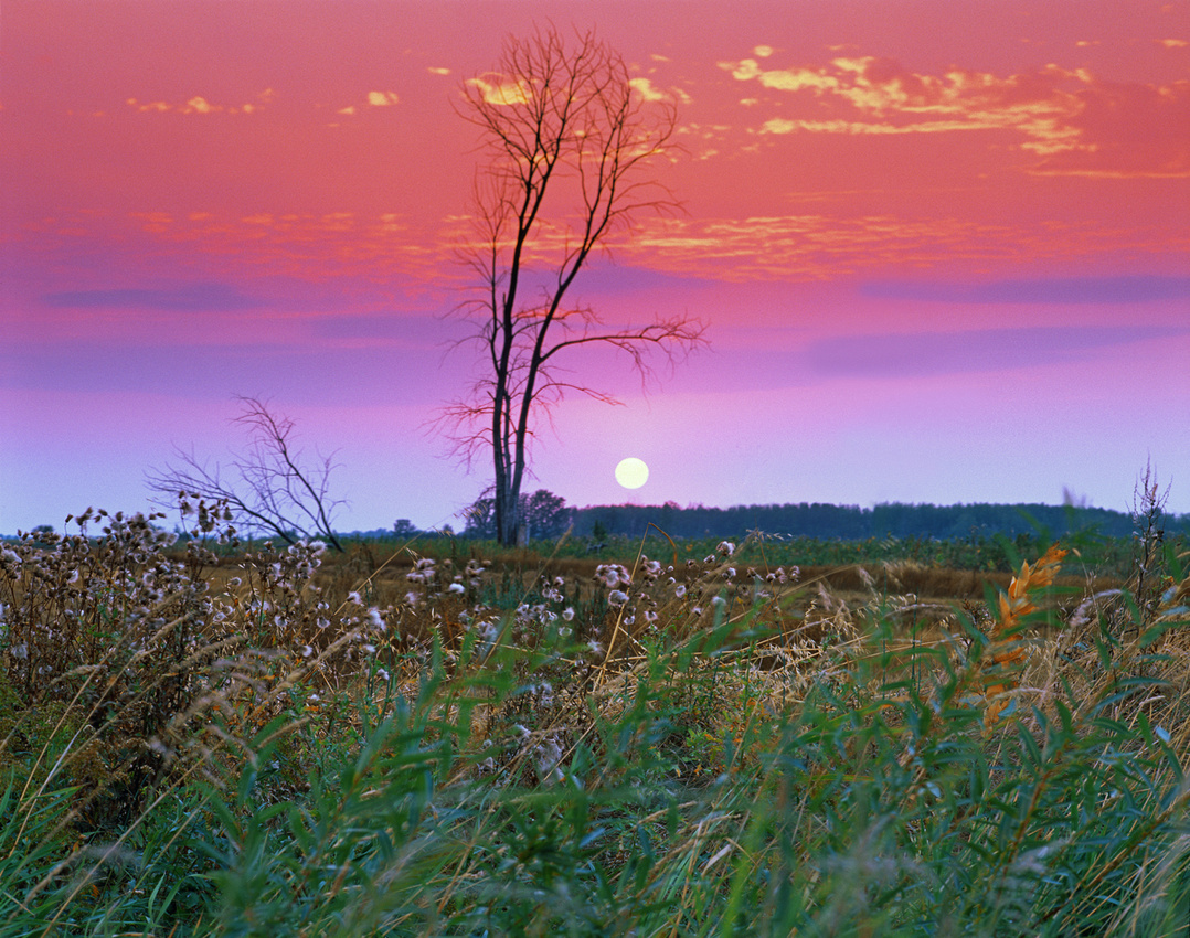
Gneiss Outcrops at TwilightGneiss Outcrops SNA

Chippewa County

Gneiss Outcrops SNA
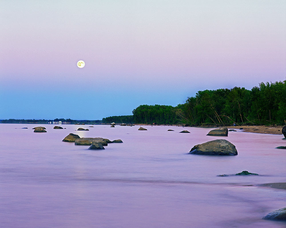
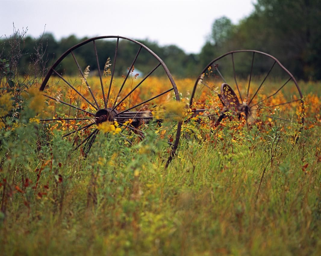
Gneiss Outcrops SNAGranite Falls, Minnesota

Chippewa County


]]>
[email protected] (Adam Johnson Minnesota Photography) Gneiss Outcrops SNA Minnesota Cactus Minnesota Sagebrush https://ajragno.zenfolio.com/blog/2016/8/gneiss-outcrops-sna Fri, 12 Aug 2016 00:35:27 GMT
John A. Latsch State Park https://ajragno.zenfolio.com/blog/2016/7/john-a-latsch-state-park John A. Lastch State Park is located along Highway 61 between Wabasha and Winona, about 100 miles or 2 hours southeast of the Twin Cities. The park has three buffs: Mount Faith, Mount Hope, and Mount Charity. The hike up Riverview Trail leads to Mount Charity, but a trail at the top suggests the other bluffs may also be accessible.

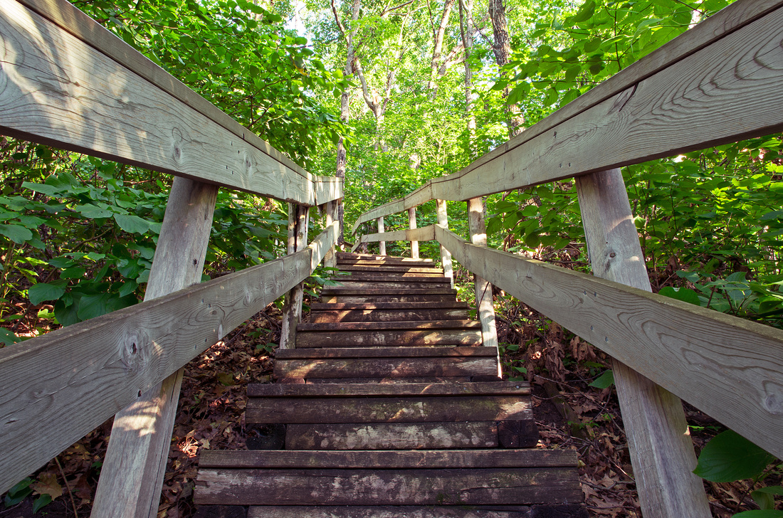
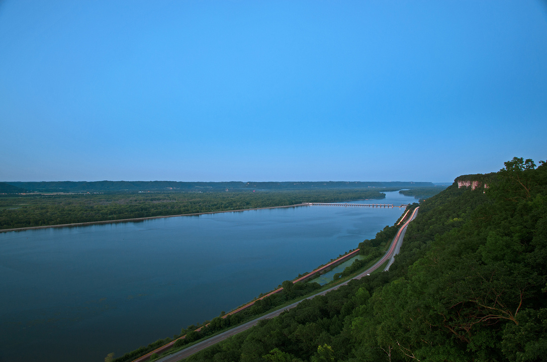
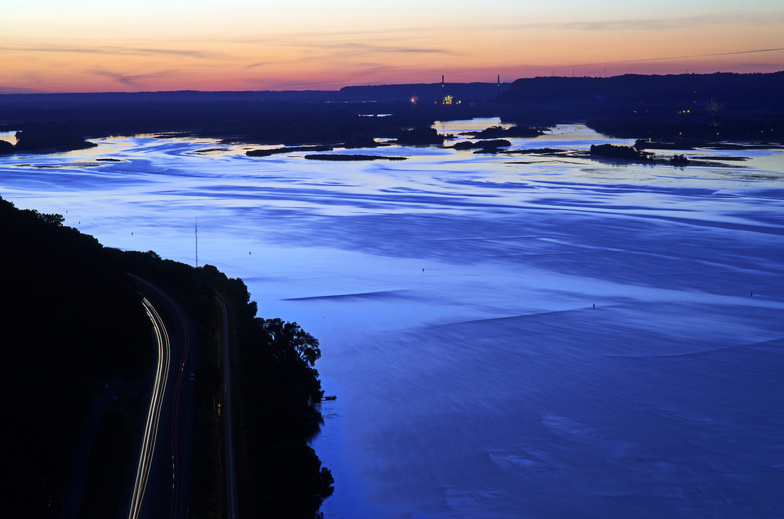
Riverview Trail was created by the Civilian Conservation Corps in 1933 and currently has 568 steps leading to the top. Though not leisurely, if I can make it with my camera gear, I’d suggest anyone wishing for a view from the top also make the effort as the views and solitude make it all worth while. With very few visitors, a rest along the way is unlikely to inconvenience anyone.

Riverview Trail StepsRiverview Trail StepsJohn A. Latsch State Park

Winona County

View from the EdgeView from the EdgeJohn A. Latsch State Park

Winona Cunty

Atop the BluffAtop the BluffJohn A. Latsch State Park

Highway 61 from the BluffHighway 61 from the BluffJohn A. Latsch State Park

Charity Bluff TwilightCharity Bluff TwilightWinona County

]]>
[email protected] (Adam Johnson Minnesota Photography) Hiking John A. Latsch State Park Minnesota Hiking Minnesota State Parks Minnesota's Best Hiking Scenic Overlook https://ajragno.zenfolio.com/blog/2016/7/john-a-latsch-state-park Fri, 08 Jul 2016 01:33:29 GMT
Ripening Soybeans https://ajragno.zenfolio.com/blog/2015/12/ripening-soybeans Intentionally misleading title because we think of plants changing color as they mature. But yellowing leaves in soybeans are actually the result of various mineral deficiencies in the soil. I met a farmer, suspicious of my activities, while photographing one such field on Labor Day in Renville County. After talking for a while, I mentioned that I've been photographing farms for a few years and that I may not have been out at the right time to notice before. He just shrugged and said, "Yep... And pretty soon the leaves 'il dry up 'n fall off..."

Ripening SoybeansRipening SoybeansRenville County

Blue Sky and Soy BeansBlue Sky and Soy BeansiPhone 5S

Renville County

Light From the HeavensLight From the HeavensRenville County

From the HeavensFrom the HeavensRenville County

Rainbow FieldsRainbow FieldsRenville County

Yellow RoadYellow RoadRenville County

Minnesota Farm Scene Ripening SoybeansMinnesota Farm Scene Ripening SoybeansSibley County


]]>
[email protected] (Adam Johnson Minnesota Photography) Ripe Soybeans Ripening Soybeans Soybean Field Soybean Fields Soybeans Yellow Soybean Field Yellowing Soybeans https://ajragno.zenfolio.com/blog/2015/12/ripening-soybeans Thu, 24 Dec 2015 05:37:05 GMT
Minnesota's Spring Crop https://ajragno.zenfolio.com/blog/2015/6/minnesotas-spring-crop When it comes to photography, because I prefer solitude to stimulation, my choices are limited to our rural farmlands and state parks and forests. Because I haven’t yet taken time to travel far from the city, I’ve instead been documenting the spring crop within 100 miles of the Twin Cities. The scenes below were captured between May 10, 2015 and June 14, 2015 in Sibley, Meeker and Nicollet Counties, and all within a 30-minute drive of one another.

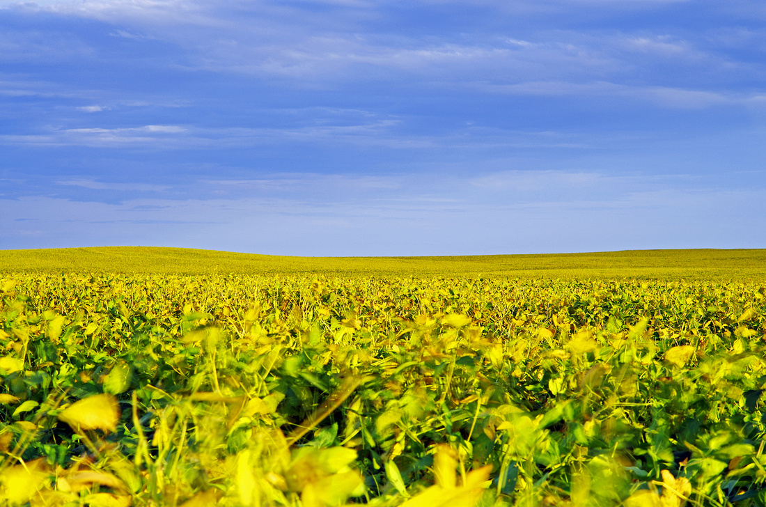
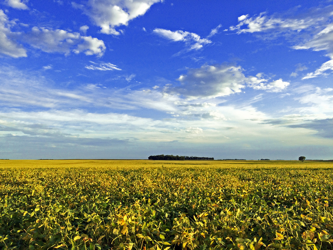
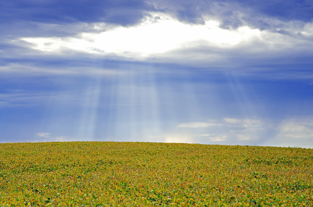
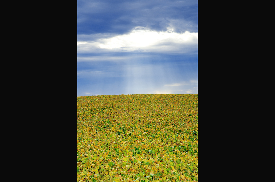
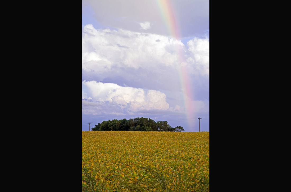
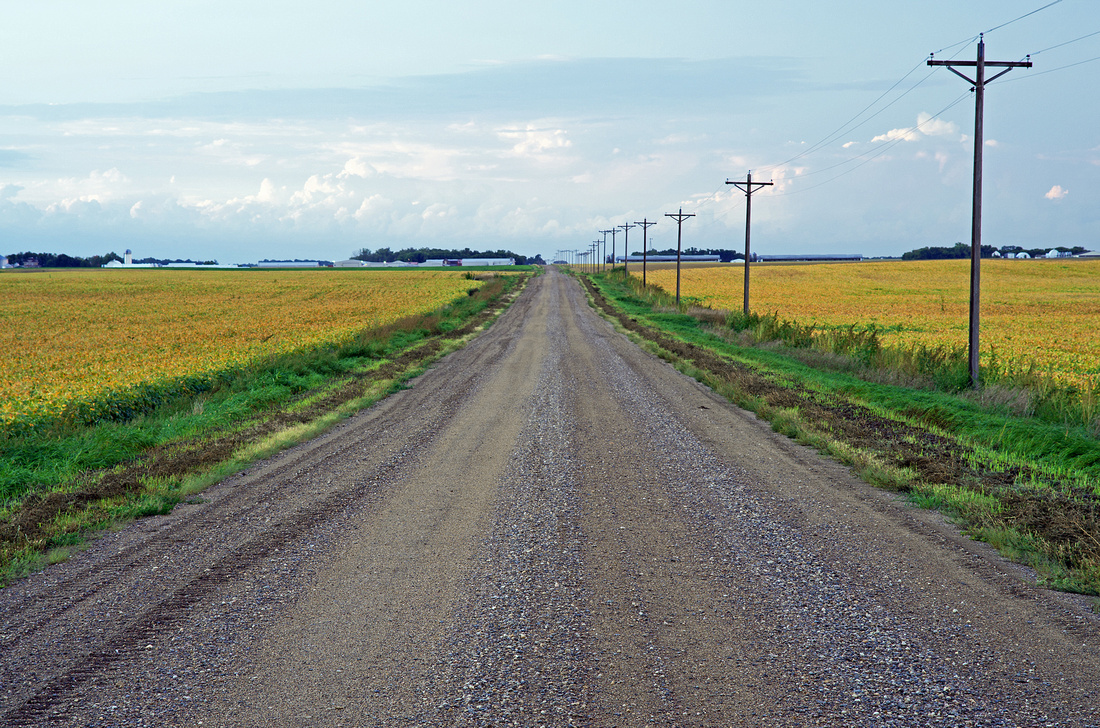
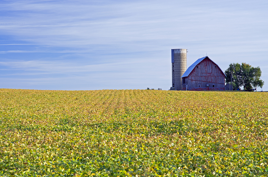
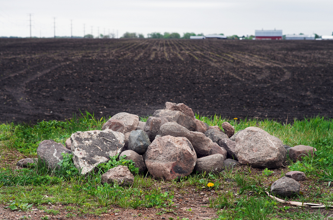
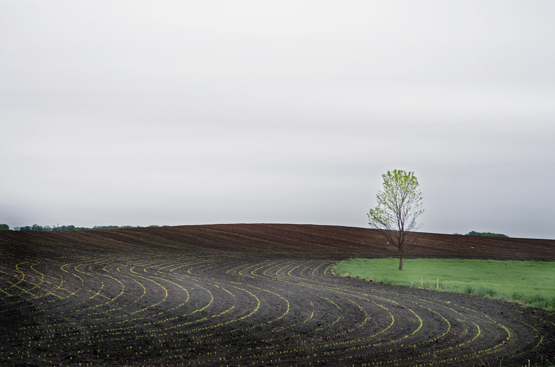
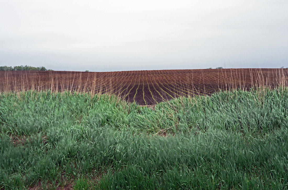
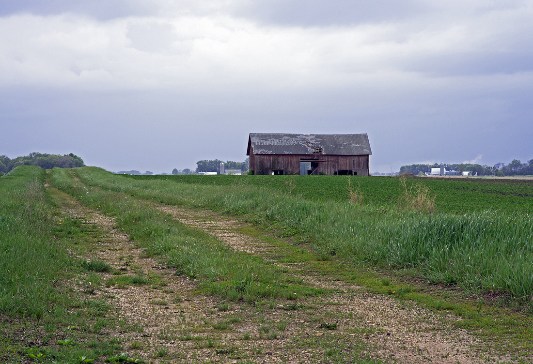
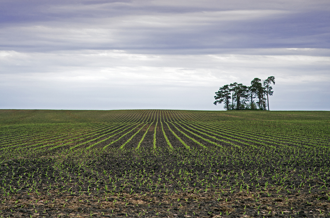
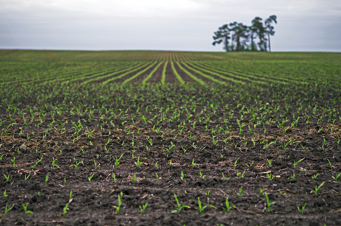
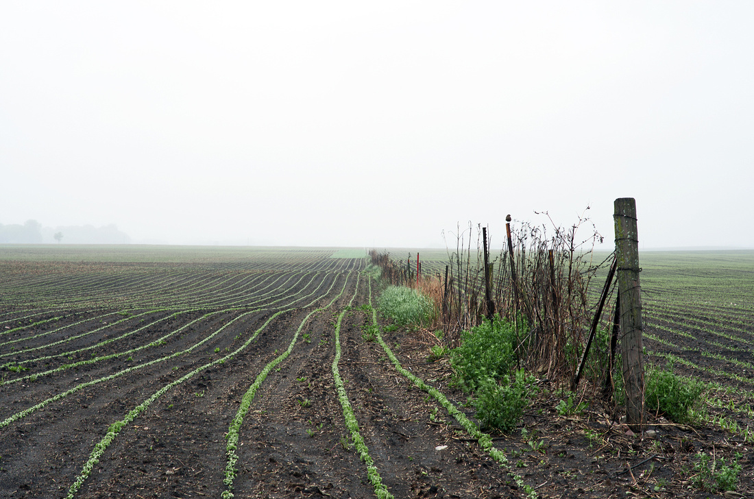
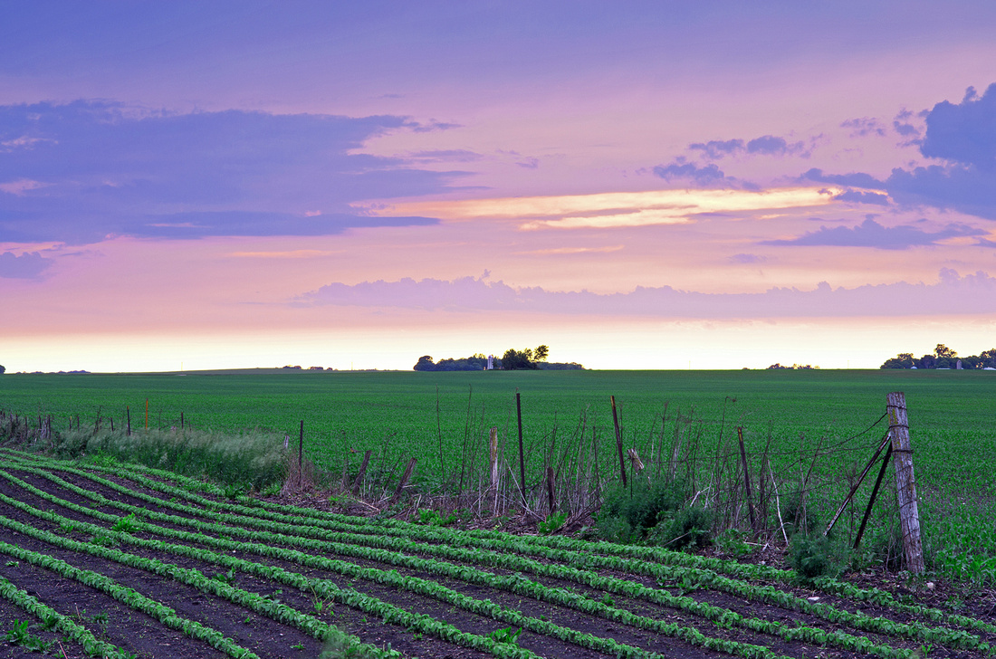
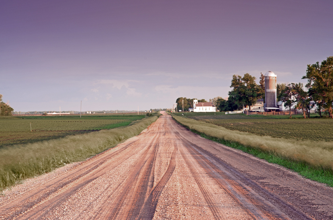
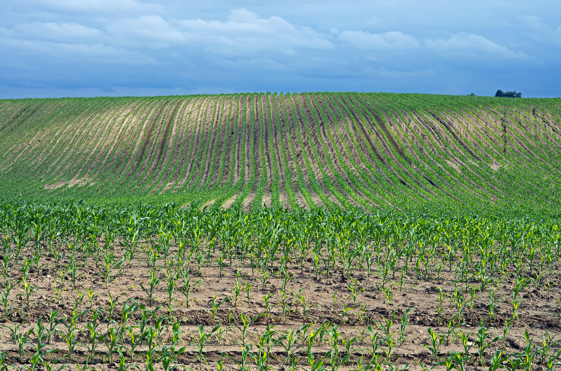
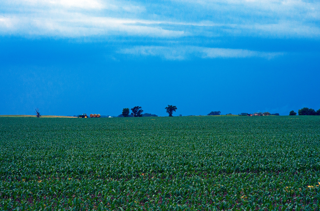
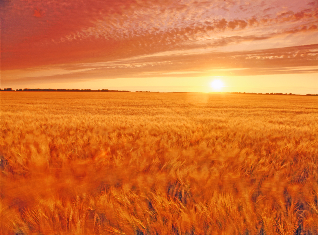
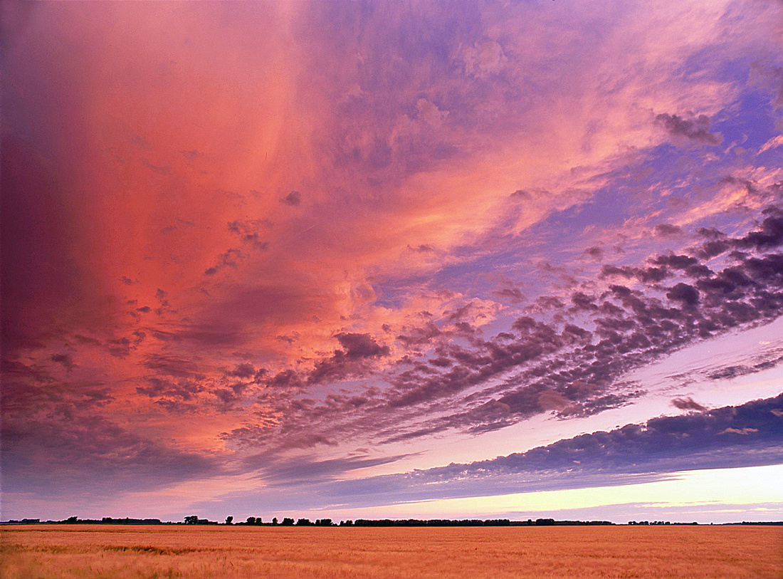
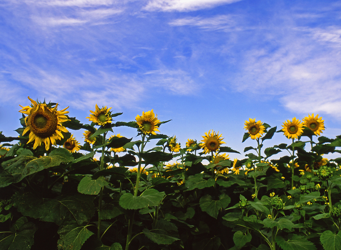
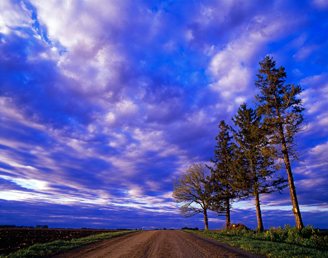
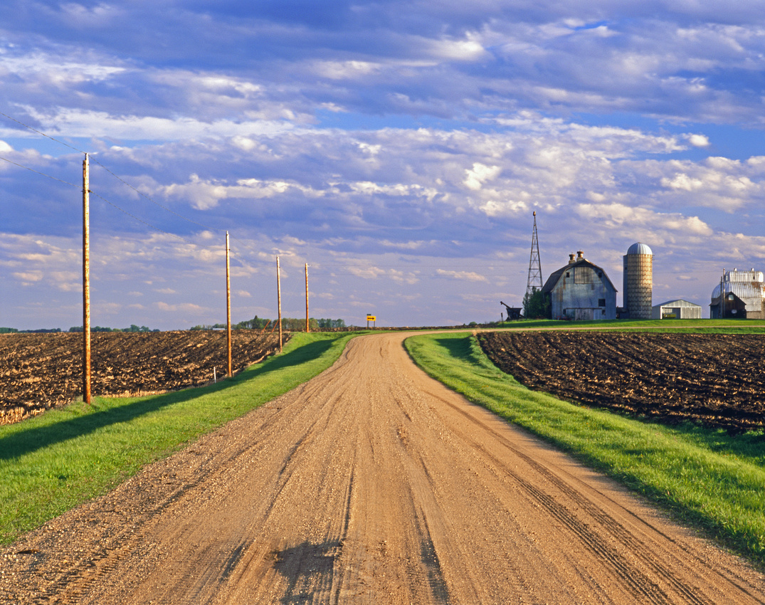
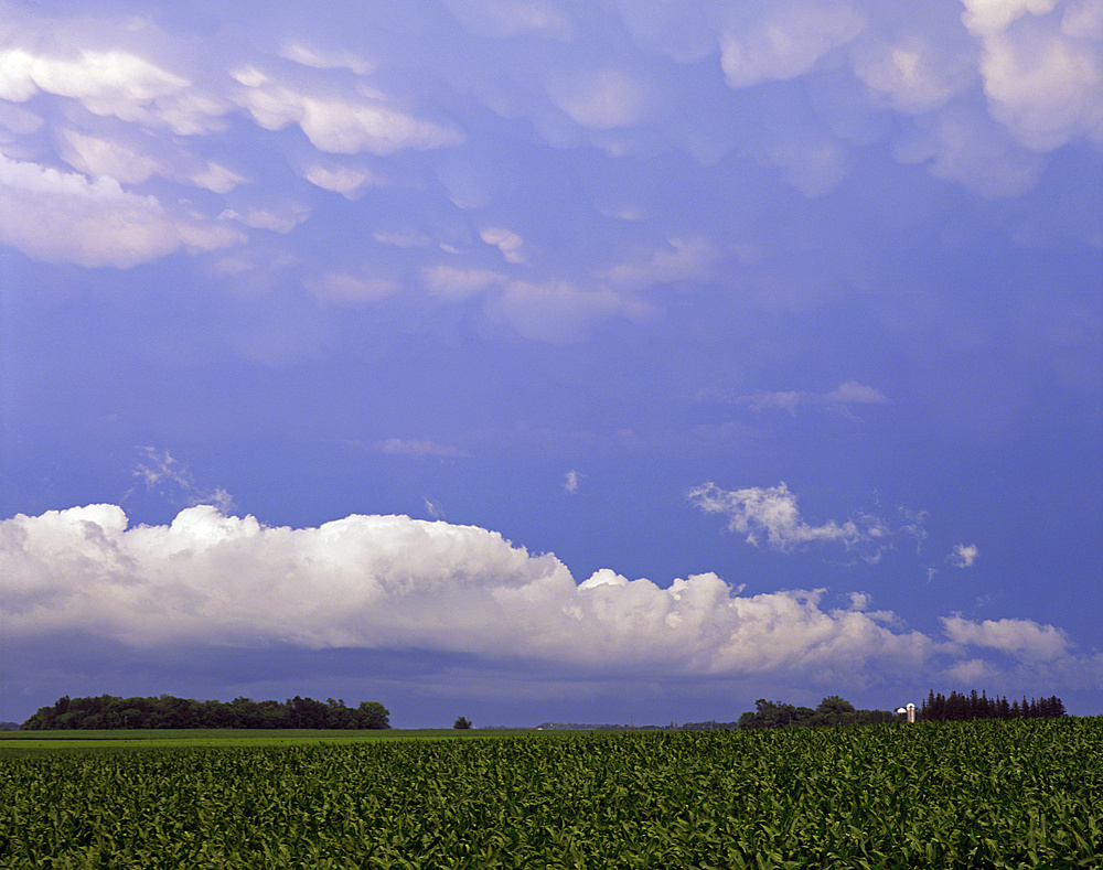
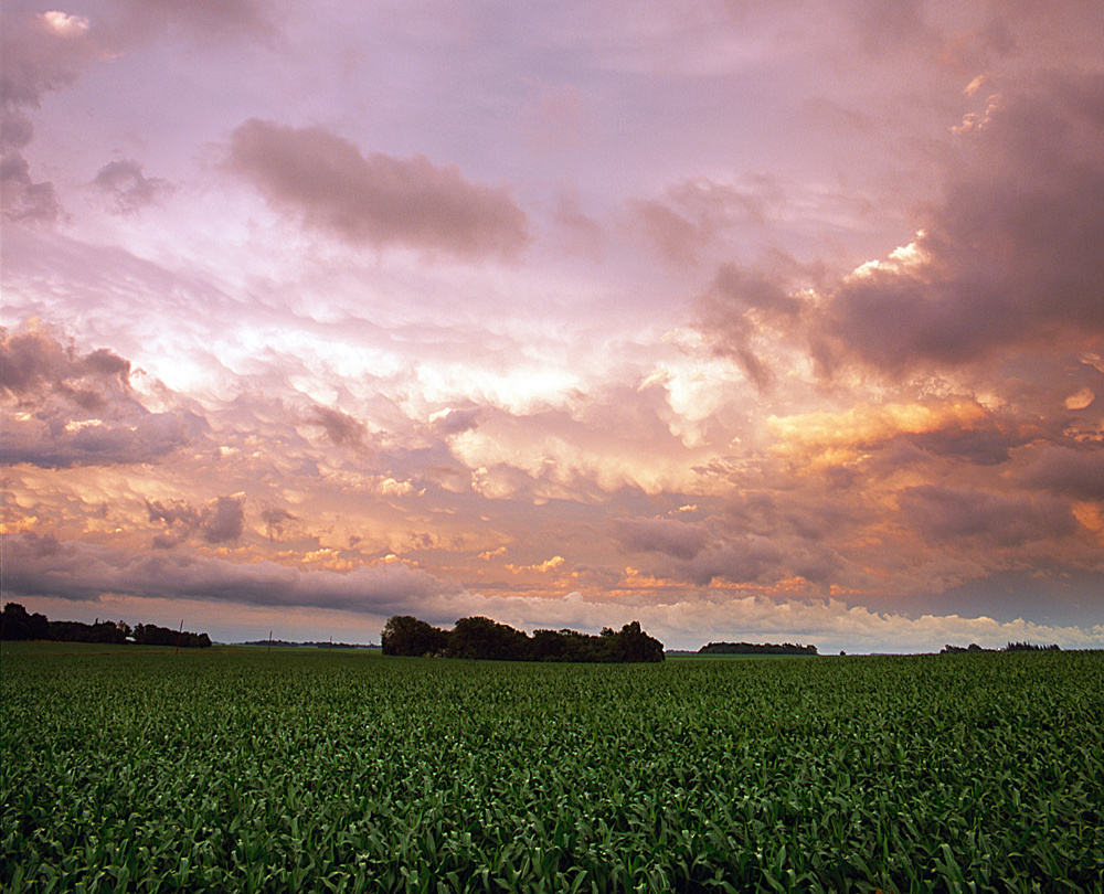
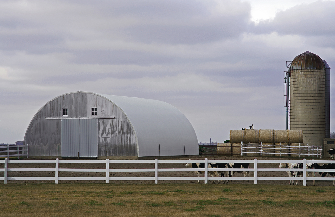
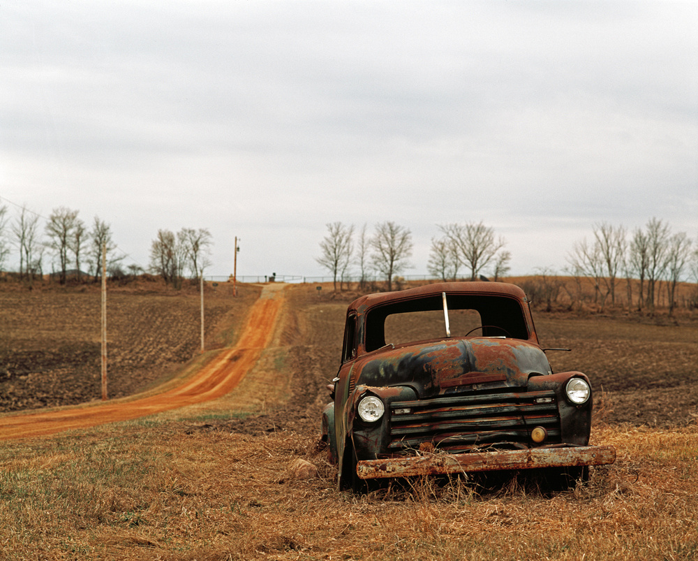
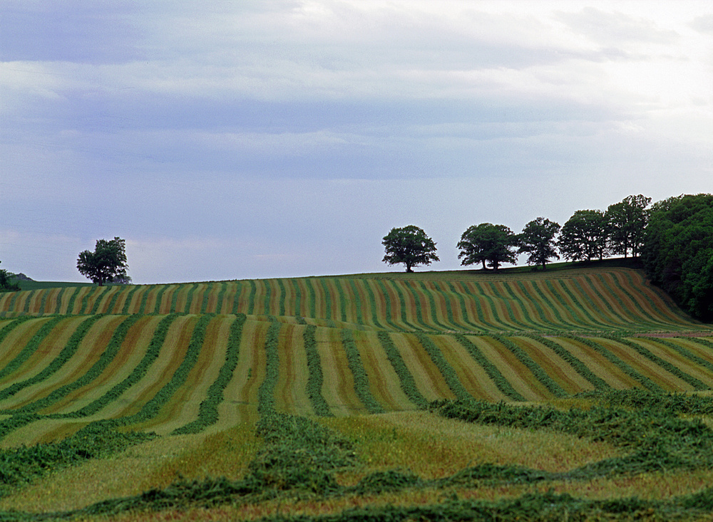
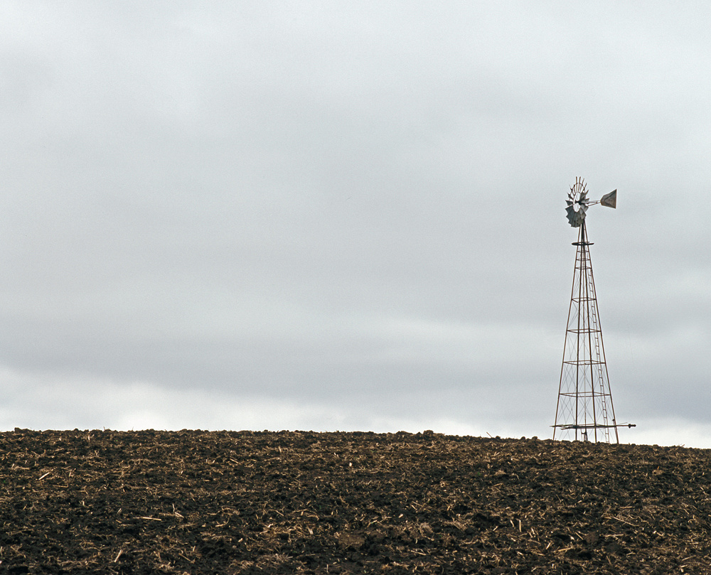
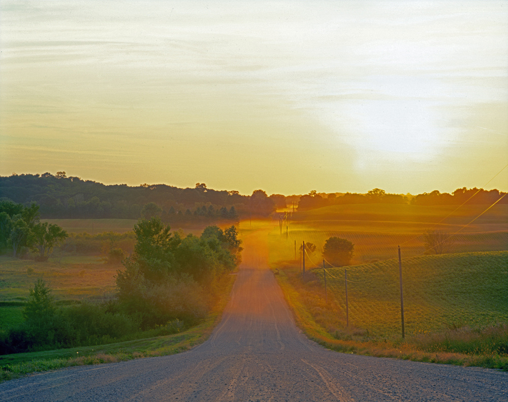
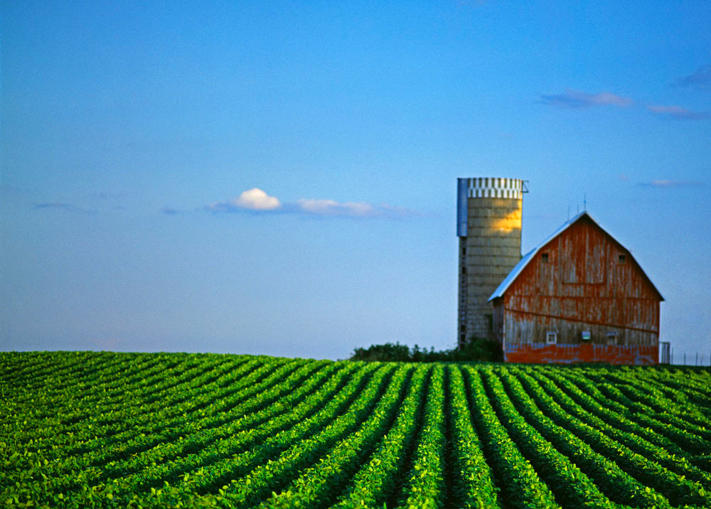
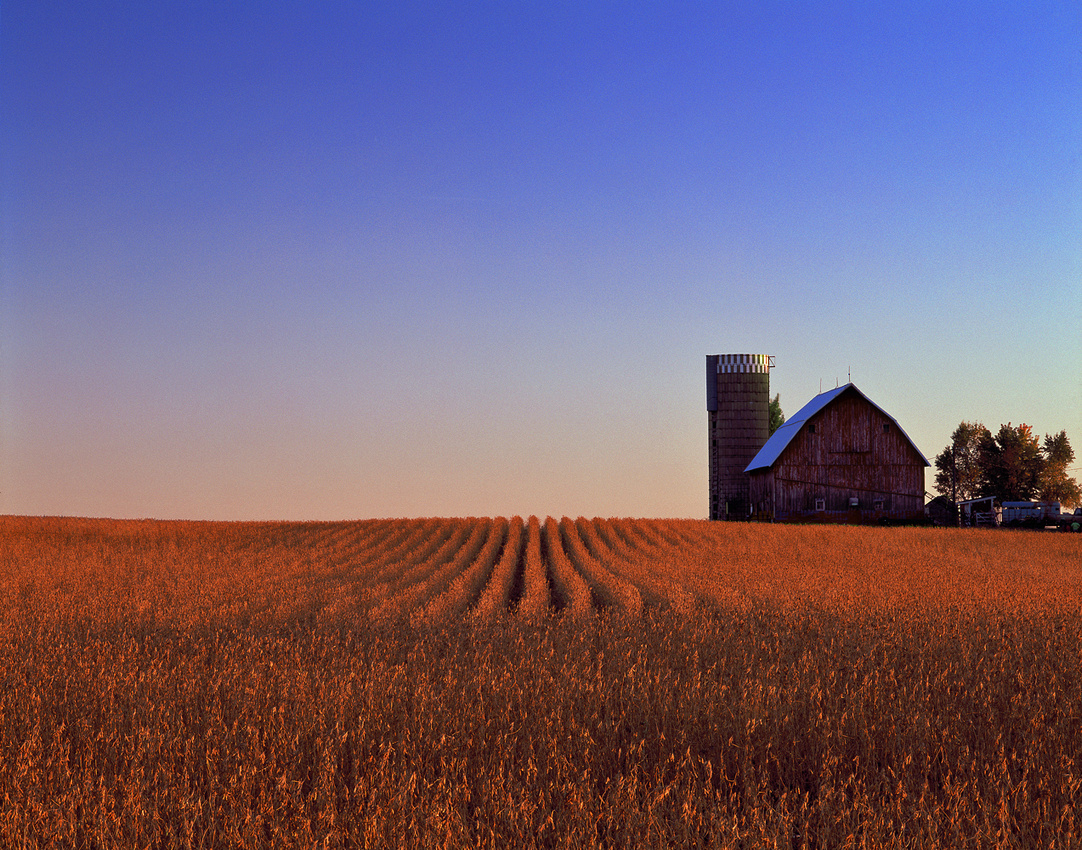
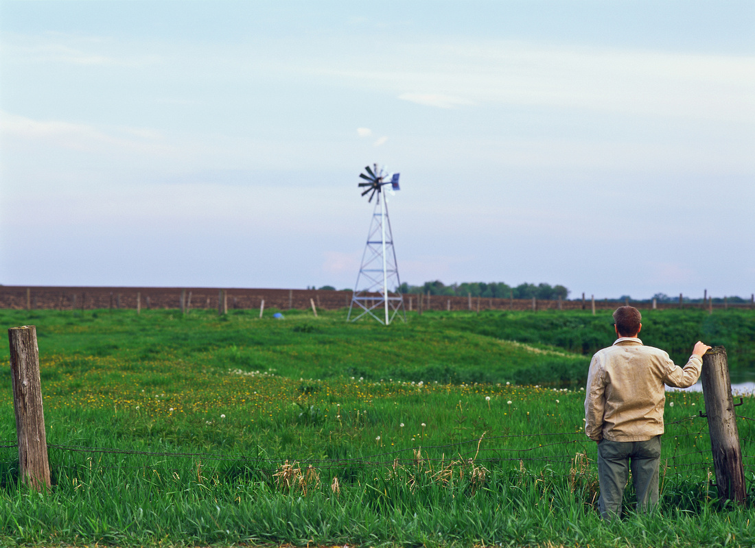
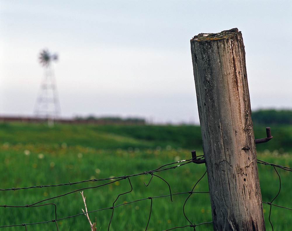
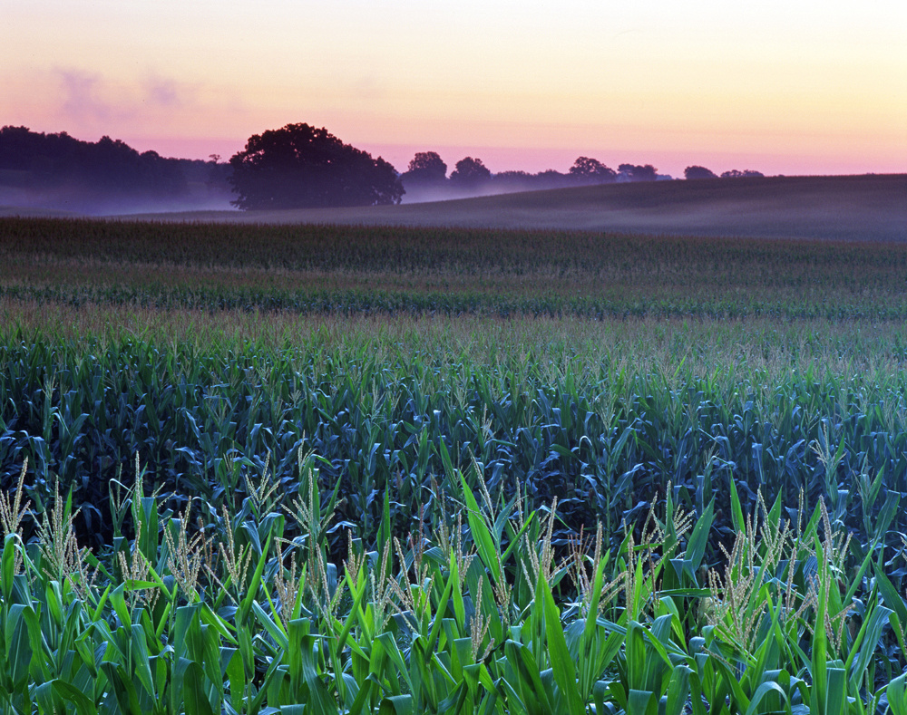
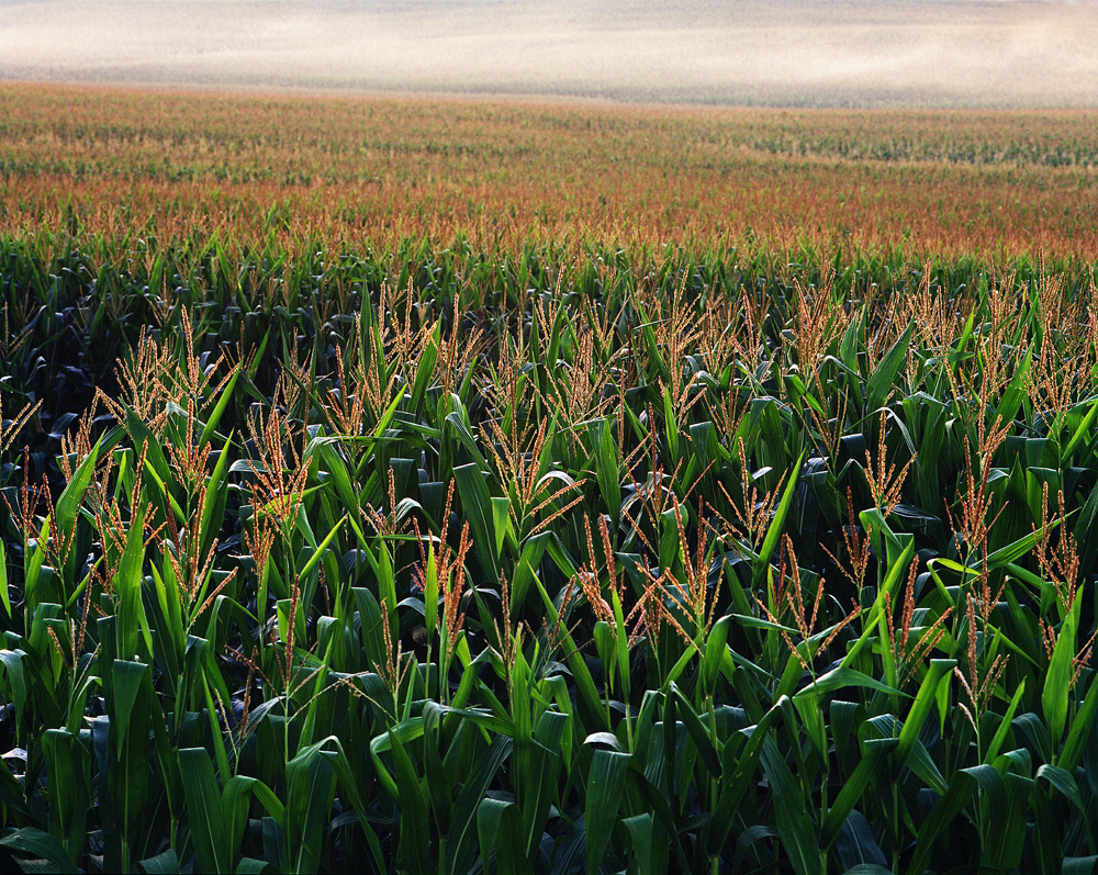
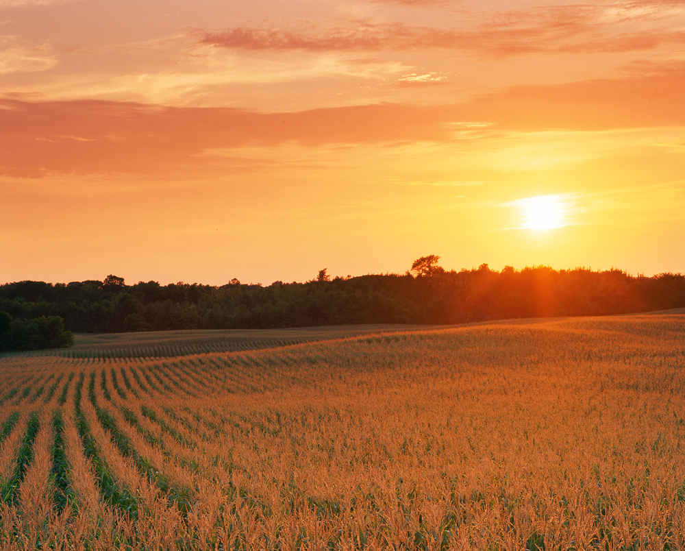
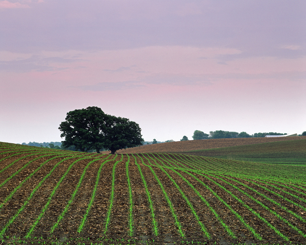
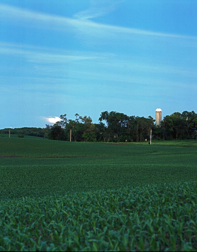
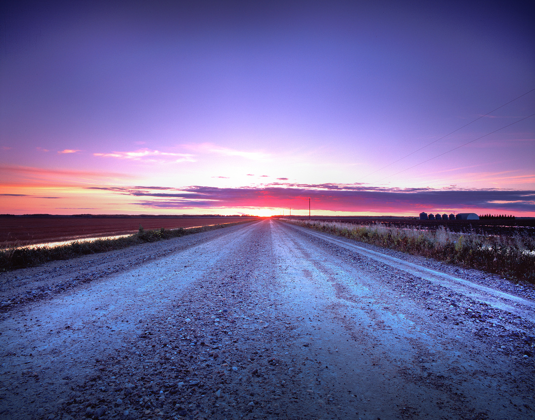
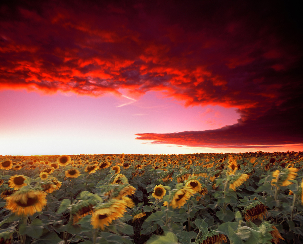
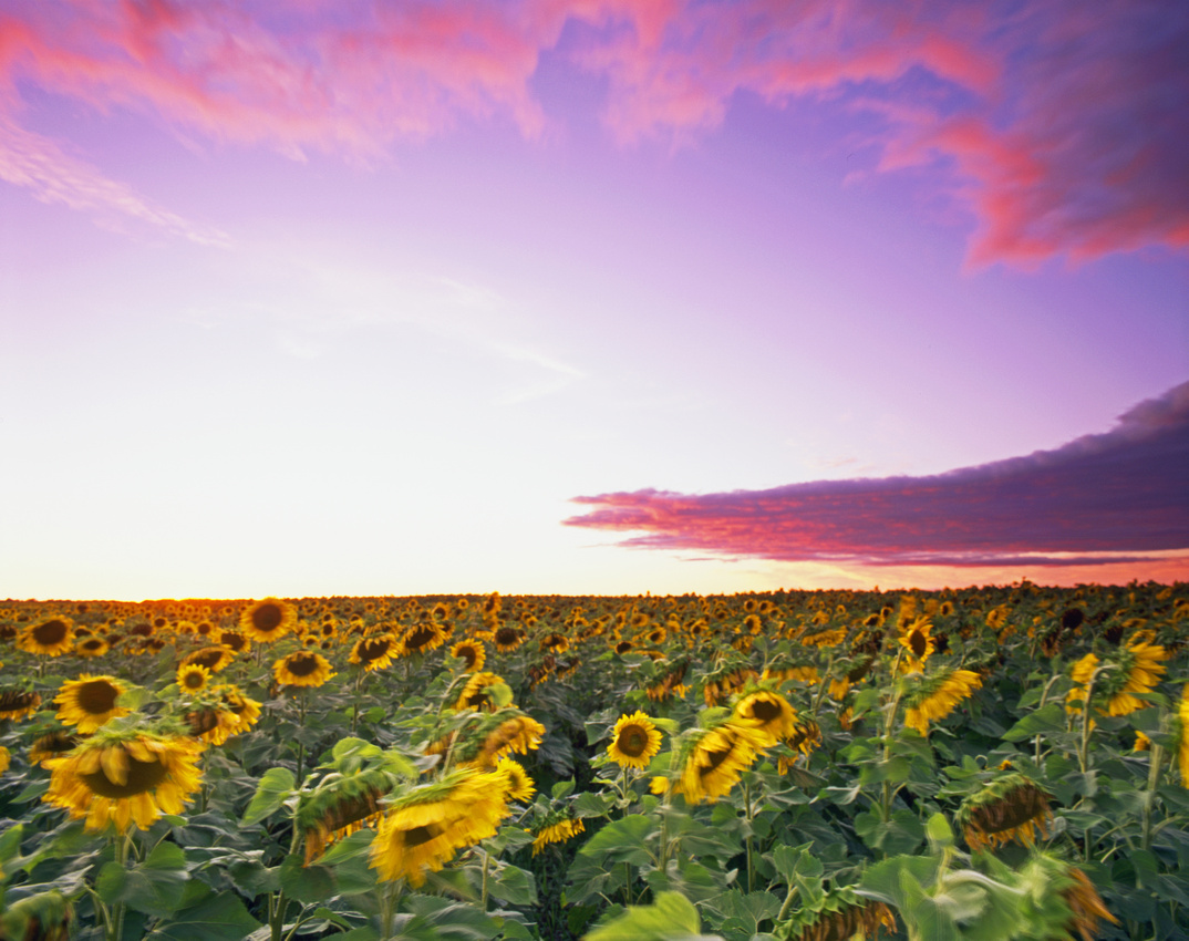
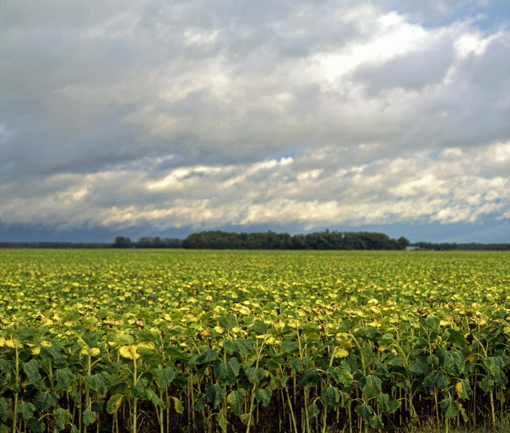
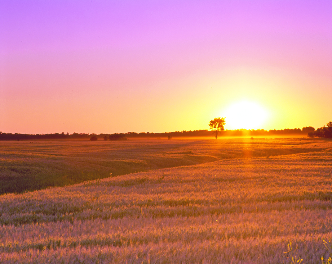
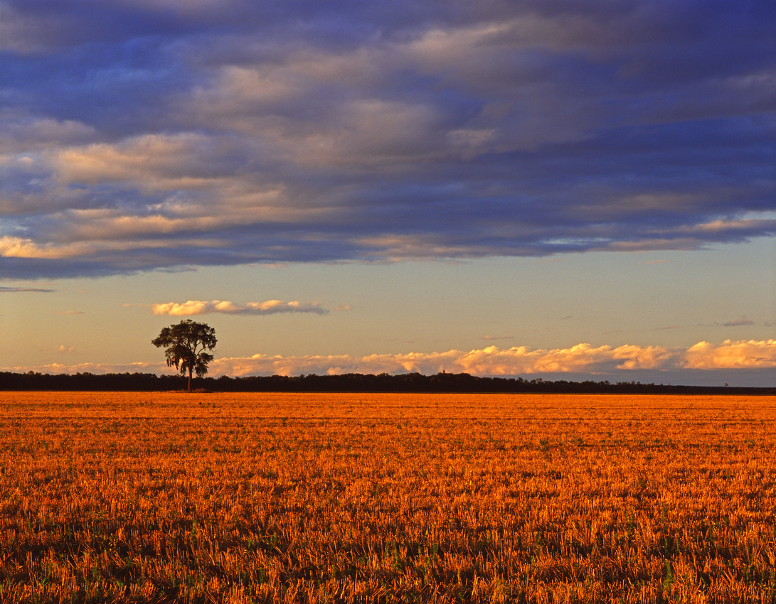
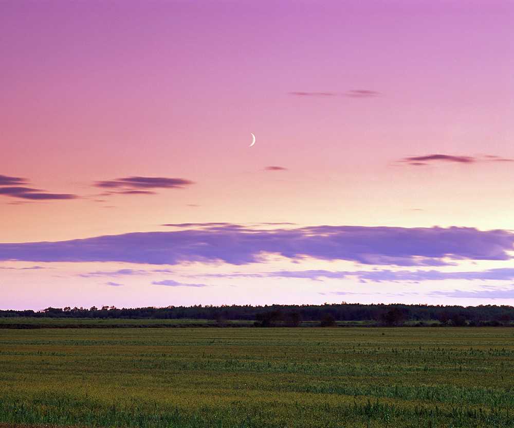
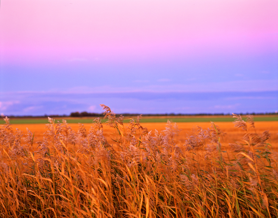
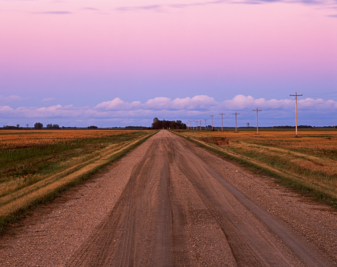
It looks to be an exceptional year for Minnesota Crops.

Sibley County
FieldstonesFieldstonesSibley County Sibley County
Edge of the FieldEdge of the FieldSibley County Sibley County Into the FieldsInto the FieldsSibley County Sibley County Winthrop, MinnesotaWinthrop, MinnesotaSibley County Sibley County Rows of CornRows of CornSibley County Sibley County Watching the Corn GrowWatching the Corn GrowSibley County Sibley County Left Out in the RainLeft Out in the RainHenderson Station, Minnesota

Le Sueur County
Nicollet County Irrigation DitchIrrigation DitchNorseland, Minnesota
Nicollet County
Nicollet County Pasture by the PondPasture by the PondNorseland, Minnesota
Nicollet County
Sibley County Fence LineFence LineSibley County Sibley County  Sibley County Fence Line at SunsetFence Line at SunsetSibley County Sibley County Crossroads FarmCrossroads FarmSibley County Meeker County Dassel CornDassel CornMeeker County Sibley County Beautiful CornBeautiful CornNew Auburn, Minnesota

Sibley County

]]>
[email protected] (Adam Johnson Minnesota Photography) Minnesota Farm Minnesota Farm Scene Srping Planting https://ajragno.zenfolio.com/blog/2015/6/minnesotas-spring-crop Fri, 19 Jun 2015 01:43:49 GMT
Lake of the Woods County https://ajragno.zenfolio.com/blog/2013/12/lake-of-the-woods-county When it comes to Lake of the Woods County, most would think of Baudette, resorts and walleye fishing on Lake of The Woods. But there’s so much more to this far away region of Northwestern Minnesota.

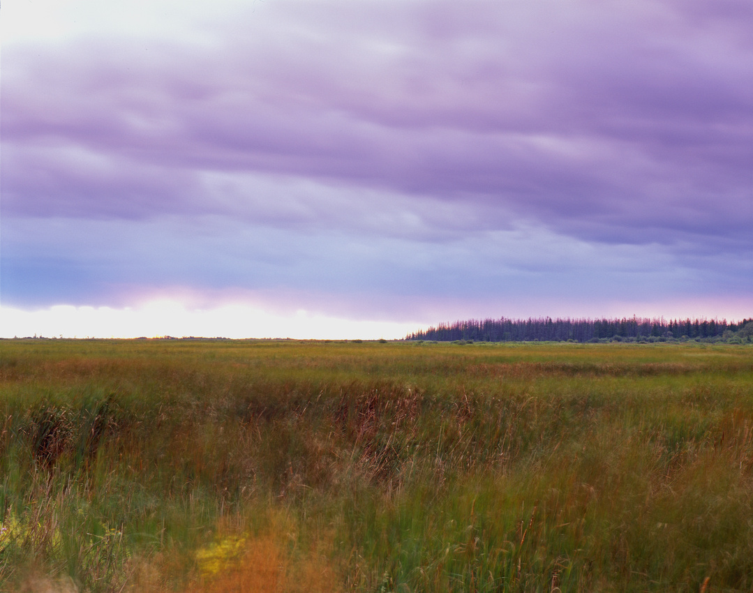
My initial exposure to Lake of the Woods County came during a late summer trip across Northern Minnesota in 2009. I’d decided to spend a few days at Zippel Bay State Park while traveling east from Thief River Falls to my eventual journey’s end in the Arrowhead and Superior National Forest. It was not until 2012 however that I decided to really explore the remoteness of Beltrami Island State Forest, a vast area of forest and wetlands, mostly abandoned by homesteaders in the mid-1930s, that I discovered what the area really has to offer: If you want to know what it’s like to have 700,000+ acres of Northern Minnesota all to yourself, drive into Beltrami Island State Forest.

Yes, Lake of the Woods is a very far drive from Minneapolis. But it’s also uniquely Minnesota and very beautiful.
PinePineZippel Bay State Park

Pentax 67 - Fuji Velvia RVP 50

Lake of the Woods County

Lake of the WoodsLake of the WoodsZippel Bay State Park, Minnesota - September 4, 2010

Pentax 67 - Fuji Velvia 100F

Lake of the Woods County


http://www.pentaxphotogallery.com/artists/AdamJohnson

Zippel Bay ShoresZippel Bay ShoresZippel Bay State Park - August 27, 2009

Lake of the Woods County

Mamiya M645 Pro - Fuji Velvia RVP 50

North Branch Rapid RiverNorth Branch Rapid RiverBeltrami Island State Forest

Lake of the Woods County
Young PineYoung PineBeltrami Island State Forest

Lake of the Woods County

Zippel Bay State ParkZippel Bay BeaconZippel Bay State Park

Lake of the Woods County

Beltrami PeatlandBeltrami PeatlandBeltrami Island State Forest

Lake of the Woods County

Roosevelt Norris Forest RoadRoosevelt Norris Forest RoadBeltrami Island State Forest

Pentax 67 - Fuji Provia RDPIII 100F

Lake of the Woods County

Beltrami Island State ForestBeltrami SunsetBeltrami Island State Forest

Pentax 67 - Fuji Provia RDPIII 100F

Lake of the Woods County

Blue MoonBlue MoonZippel Bay State Park

Pentax 67 - Fuji Velvia RVP 50

Lake of the Woods County

Beach at Zippel Bay State ParkBeach at Zippel Bay State ParkZippel Bay State Park, Minnesota - September 4, 2010

Pentax 67 - Fuji Velvia RVP 50

Lake of the Woods County


Waning twilight...

The very serene Zippel Bay State Park is located on the Southern shores of Lake of the Woods in extreme Northwestern Minnesota, about 1/2 hour east of Warroad, MN. After a few visits, I'd come to realize this park's calm and quiet atmosphere is own to the simple fact that there are no electrical hookups for the RV crowd, and the city slickers.

Zippel Bay has 57 camp sites, and even the Labor Day weekend of this year only saw 27 of those sites occupied. If you like seclusion, this is THE PARK to find your peace while camping.

This campfire was lit to warm the kids after we'd been swimming in water cooler than the air of this early September night. As we were all getting ready to head back to the campsite, I was inspired to take a few minutes to re-light the fire for this photograph.

Zippel Bay MoonriseZippel Bay MoonriseZippel Bay State Park, Minnesota - August 13, 2011

Pentax 67 - Fuji Velvia RVP 50


Lake of the Woods County

Zippel BayZippel BayZippel Bay State Park - August 27, 2009

Lake of the Woods County


Mamiya M645 Pro - Fuji Velvia RVP 50

Lake of the Woods HazeLake of the Woods HazeZippel Bay State Park - August 26, 2009

Lake of the Woods County

Mamiya M645 Pro - Fuji Velvia RVP 50

Lake of the WoodsLake of the WoodsZippel Bay State Park - August 26, 2009

Lake of the Woods County

Mamiya M645 Pro - Fuji Velvia RVP 50

End of Civil Twilight at Zippel BayEnd of Civil Twilight at Zippel BayZippel Bay State Park - August 26, 2009

Lake of the Woods County

Mamiya M645 Pro - Fuji Velvia RVP 50

Hand Pump At Zippel Bay State ParkHand Pump At Zippel Bay State ParkZippel Bay State Park - August 27, 2009

Lake of the Woods County

Mamiya M645 Pro - Fuji Velvia RVP 50

After setting up camp in the Ridge Campground, I went out on a walk and noticed this freshly painted fire engine red hand pump. At 10am the next morning, the light was perfect.

Zippel Bay CampingZippel Bay CampingZippel Bay State Park

Lake of the Woods County

Baudette, MinnesotaBaudette, MinnesotaHighway 1, Baudette, Minnesota
 

]]>
[email protected] (Adam Johnson Minnesota Photography) Baudette MN Beltrami Island State Forest Lake of the Woods Zippel Bay Zippel Bay State Park https://ajragno.zenfolio.com/blog/2013/12/lake-of-the-woods-county Sun, 08 Dec 2013 03:21:25 GMT
Marshall County, Minnesota https://ajragno.zenfolio.com/blog/2013/12/marshall-county-minnesota I spent 2 weeks on the late summer of 2009 wandering from Northwestern to Northeaster, Minnesota. To begin, I drove from my home in Minneapolis to Old Mill State Park north of Thief River Falls.

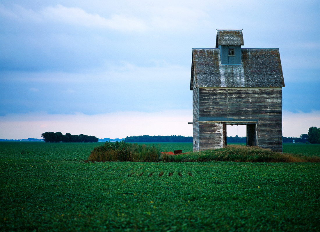
On the 2nd day of my stay, it rained on and off all day. A few hours before sunset, I was determined to drive to the North Dakota border and find a train trestle across the Red River to photographed at sunset. I drove west on highway 1 out of Thief River Falls until I noticed a very tall Granary on the north side of the road and decided to stop for a photograph.

Deer are thick like rodents on Marshall County and I imagine this granary now primarily used as a hunting stand, but so majestic.

"Farm Scene"March, Minnesota"March, Minnesota"
"Farm Scene""Wavering Wheat""Wavering Wheat" Alvarado, Minnesota
"Farm Scene" "Red River Valley""Red River Valley""Red River Valley" Alvarado, Minnesota
"Sunflowers" "Minnesota Sunflowers""Sunflowers""Sunflowers" Newfolden, Minnesota

http://farmscene.files.wordpress.com/2013/12/flattness-of-the-red-river-valley.jpg


]]>
[email protected] (Adam Johnson Minnesota Photography) Farm Scene Marshall County Minnesota Farm Minnesota Farm Scene Minnesota Farms https://ajragno.zenfolio.com/blog/2013/12/marshall-county-minnesota Tue, 03 Dec 2013 04:32:12 GMT
Nicollet County, Minnesota https://ajragno.zenfolio.com/blog/2013/12/nicollet-county-minnesota Nicollet County is west of Sibley County, so it’s a bit more difficult for me to travel to, but the farmlands are very, very rich indeed, with either flat farmlands or gently sloping hills. The only city with a sizable population is St. Peter. The rest of the county is made up almost entirely of unincorporated townships.

New Sweden, MinnesotaNew Sweden, MinnesotaNicollet County

Pentax 67 - Fuji Velvia RVP 50


There it was, the light I’d been searching for all evening, and I just drove right past it. I had been driving for hours on gravel farm roads southwest of Minneapolis - west, then north, then west again, zigzagging my way through the Minnesota countryside without a destination, and getting futher and further from home on roads I’d never seen on maps.

Most of the scenes I photograph are places you wouldn’t notice if you live there because they are seen every day. And unless you live there, you really wouldn’t have much reason to be out there anyway. This road is not on the way to anywhere, and there really isn’t much out here except for the scenery, and who has time for that?

This is New Sweden, Minnesota. Population 326. There are farms, farm houses, and churches. And on this day in May, beautiful light…

Bernadotte, MinnesotaBernadotte, MinnesotaNicollet County Minnesota

May 01, 2010


Pentax 67 - Fuji Velvia RVP 50


New Sweden Storm 2New Sweden Storm 2Nicollet County
New Sweden Storm CropNew Sweden Storm CropNew Sweden, Minnesota

Nicollet County

New Sweden, MinnesotaNew Sweden, MinnesotaNicollet County

June 18, 2010

Pentax 67 - Fuji Provia 100F

]]>
[email protected] (Adam Johnson Minnesota Photography) Farm Scene Minnesota Corn Minnesota Farm Scene https://ajragno.zenfolio.com/blog/2013/12/nicollet-county-minnesota Tue, 03 Dec 2013 03:17:27 GMT
Carver County, Minnesota https://ajragno.zenfolio.com/blog/2013/12/carver-county-minnesota Continue west through Chaska on Highway 212 and you’ll find the rolling hills of Augusta and the vast corn fields of Hamburg.

Carver County Farm SceneCarver County Farm SceneYoung America, Minnesota

Sibley County

Winter Farm SceneWinter Farm SceneYoung America, Minnesota

Sibley County

Cool Blue SkyCool Blue SkySibley County
Hamburg, MinnesotaHamburg, MinnesotaHamburg, Minnesota - June 27, 2009

Sibley County

Mamiya M645 Pro - Fuji Velvia RVP 50

Highway 43 Junk TruckHighway 43 Junk TruckDahlgren, Minnesota - March 27, 2010

Carver County


Pentax 67 - Fuji Velvia RVP 50

Alfalfa FieldAlfalfa FieldAugusta, Minnesota

Carver County

Cologne, MinnessotaCologne, MinnessotaCologne, Minnesota - April 24, 2010

Carver County


Pentax 67 - Fuji Velvia RVP 50

Augusta Dusty RoadsAugusta Dusty RoadsAugusta, Minnesota September 10, 2011

Carver County

Pentax 67 - Fuji Velvia RVP 50

Augusta, MinnesotaAugusta, MinnesotaCarver County

June 19, 2010

Pentax 67 - Fuji Velvia RVP 50

The Rising MoonThe Rising MoonAugusta, Minnesota September 10, 2011

Carver County


Pentax 67 - Fuji Velvia RVP 50

Zoar Moravian ChurchZoar Moravian ChurchAugusta, Minnesota September 10, 2011

Carver County

Pentax 67 - Fuji Velvia RVP 50

Carver County LinesCarver County LinesCarver County
Assumption, MinnesotaAssumption, MinnesotaAssumption, Minnesota - April 10, 2010

Sibley County


Pentax 67 - Fuji Velvia RVP 50


]]>
[email protected] (Adam Johnson Minnesota Photography) Carver County Carver County Farms Farm Farm Scene Minnesota Scene" https://ajragno.zenfolio.com/blog/2013/12/carver-county-minnesota Tue, 03 Dec 2013 00:04:25 GMT
Lake Rebecca Park Reserve https://ajragno.zenfolio.com/blog/2013/11/lake-rebecca-park-reserve If you're not familiar with Lake Rebecca Park Reserve, it's located just southeast of Rockford, MN and part of the Three Rivers Park District. With farms to the south and east, the park is a lowland area of wetlands with hiking and horse trails, as well as Lake Rebecca itself. Though anyone local is likely to know about the park, it's still secluded and a perfect getaway from the city without having to drive too far.  

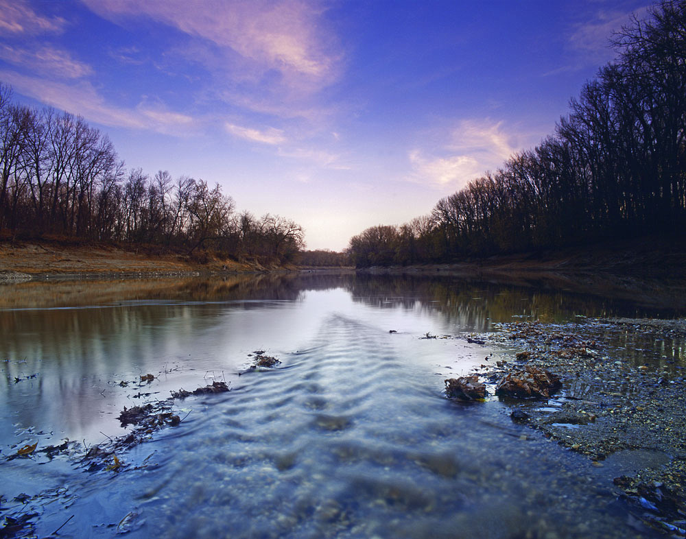
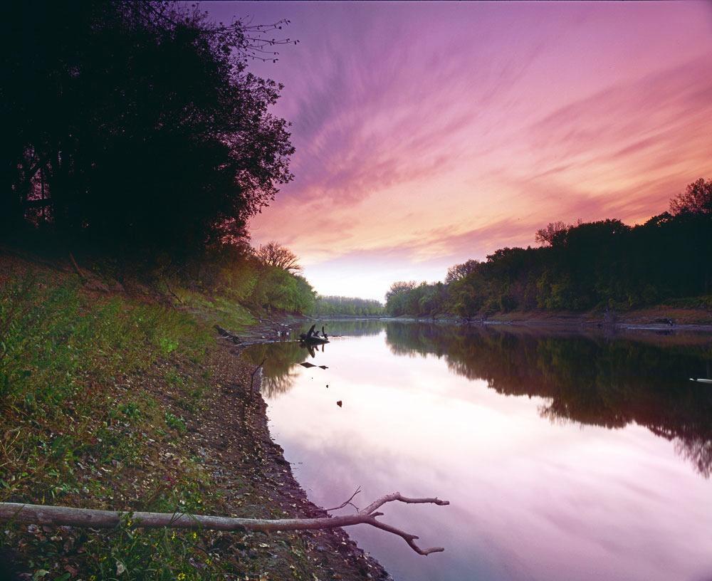
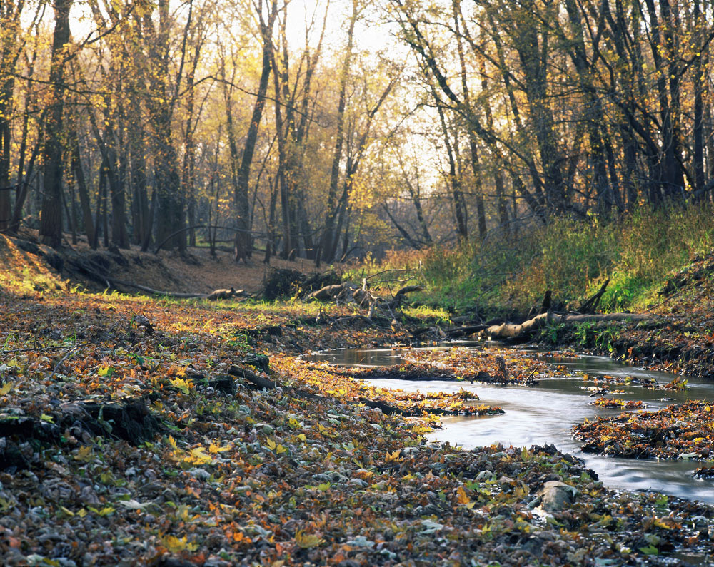
Because the park is just a short drive west of Minneapolis on Highway 55, I find myself here quite regularly for hiking and photography, year round. The images below show the park from Spring's ice-out through Fall.

Weathered WoodWeathered WoodLake Rebecca Park Reserve

Hennepin County

Sunset Over Lake RebeccaSunset Over Lake RebeccaLake Rebecca Park Reserve

Hennepin County

Spring meadowSpring meadowLake Rebecca Park Reserve

Hennepin County

Light Reflected On LeavesLight Reflected On LeavesLake Rebecca Park Reserve

Hennepin County

Lake Rebecca CattailsLake Rebecca CattailsLake Rebecca Park Reserve

Hennepin County

Nature's GardenNature's GardenLake Rebecca Park Reserve

Hennepin County

Gorge In FallGorge In FallLake Rebecca State Park - Rockford, Minnesota October 15, 2012

Hennepin County

Pentax 67 - Fuji Velvia RVP 50

RavineRavineLake Rebecca Park Reserve - Rockford, Minnesota

Hennepin County

Lake Rebecca FieldLake Rebecca FieldLake Rebecca Park Reserve

Hennepin County

Lake RebeccaLake RebeccaLake Rebecca Park Reserve - Rockford, Minnesota

Hennepin County


]]>
[email protected] (Adam Johnson Minnesota Photography) Lake Rebecca Park Reserve Three Rivers Park District https://ajragno.zenfolio.com/blog/2013/11/lake-rebecca-park-reserve Fri, 22 Nov 2013 23:06:37 GMT
Sibley County Farms https://ajragno.zenfolio.com/blog/2013/11/sibley-county-farms Sibley County became one of my favorite areas to explore in 2009 because it was within about and hour’s drive of Minneapolis via Highway 169 and Highway 212. Once there, I could drive the grid of farm roads till finding just the right scene and wait for the light. Some of my favorite images come from Sibley County.

Minnesota Farm SceneMinnesota Farm SceneNew Rome, Minnesota - July 24, 2009

Mamiya M645 Pro - Fuji Velvia RVP 50

Sibley County


Rush River GranaryRush River GranarySibley County

April 09, 2010


Pentax 67 - Fuji Velvia RVP 50


Rush River GranaryRush River GranarySibley County

April 09, 2010


Mamiya M645 Pro - Fuji Velvia RVP 50


Minnesota Farm Scene 2011Minnesota Farm Scene 2011New Rome, Minnesota October 1, 2011

Sibley County


Pentax 67 - Fuji Velvia RVP 50


]]>
[email protected] (Adam Johnson Minnesota Photography) Farm Scene Minnesota Farm Scene https://ajragno.zenfolio.com/blog/2013/11/sibley-county-farms Tue, 12 Nov 2013 00:13:24 GMT
Hennepin County Farms https://ajragno.zenfolio.com/blog/2013/11/hennepin-county-farms Yes, there are indeed farms in Hennepin County. In fact, much of the land west of Cty 116 in Medina is still used for crops. All of the images below were captured in Greenfield, Minnesota.

Foggy Morning in the CornfieldFoggy Morning in the CornfieldHennepin County

Endless CornEndless CornHennepin County

Greenfield SunsetGreenfield SunsetGreenfield, Minnesota

Hennepin County


Freshly Planted Rows of CornFreshly Planted Rows of CornGreenfield, Minnesota

Hennepin County

Pentax 67 - Fuji Velvia RVP 50


Moon Rising on a Cloudy NightMoon Rising on a Cloudy NightGreenfield, Minnesota

Hennepin County

]]>
[email protected] (Adam Johnson Minnesota Photography) Farm Farming Minnesota Cornfields Minnesota Farms https://ajragno.zenfolio.com/blog/2013/11/hennepin-county-farms Mon, 11 Nov 2013 23:45:14 GMT
Arcola Soo Line Bridge https://ajragno.zenfolio.com/blog/2013/3/arcola-soo-line-bridge Arcola Soo Line Bridge
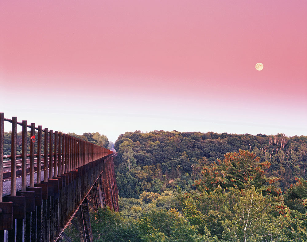
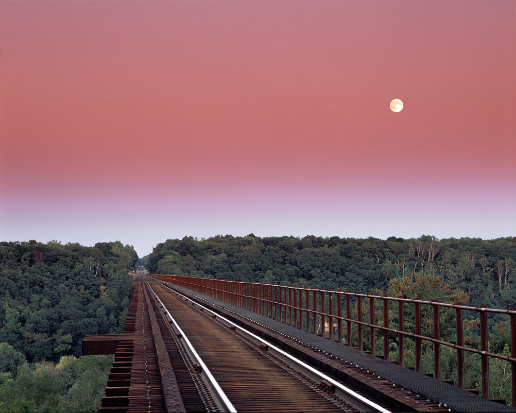
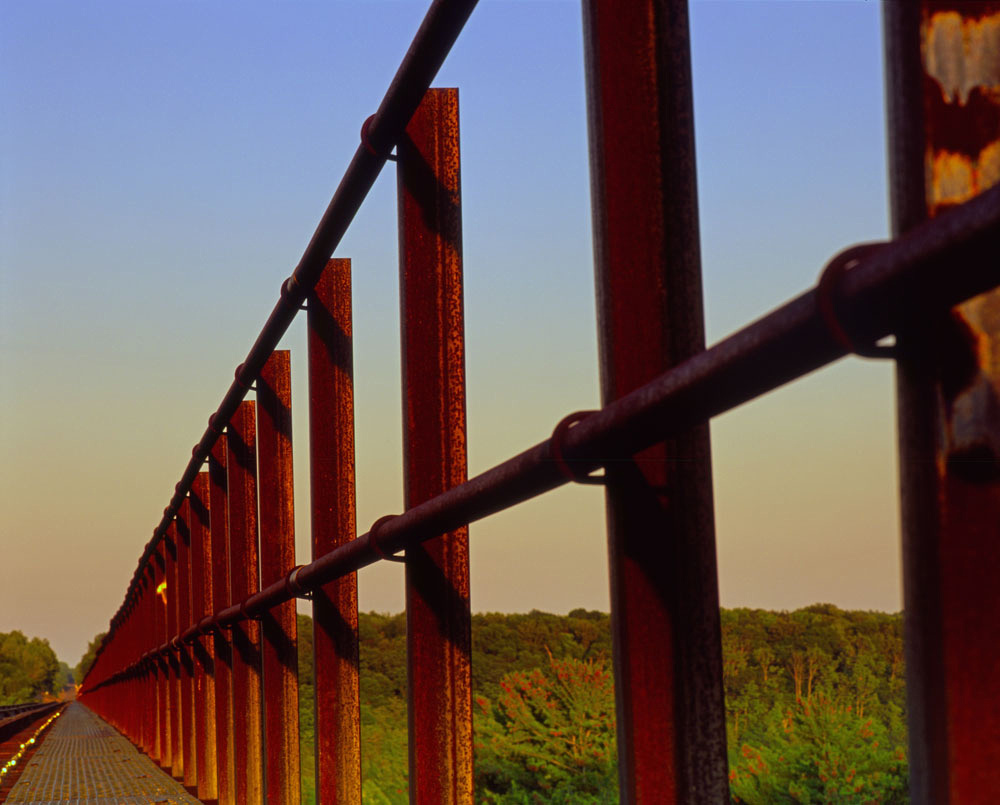
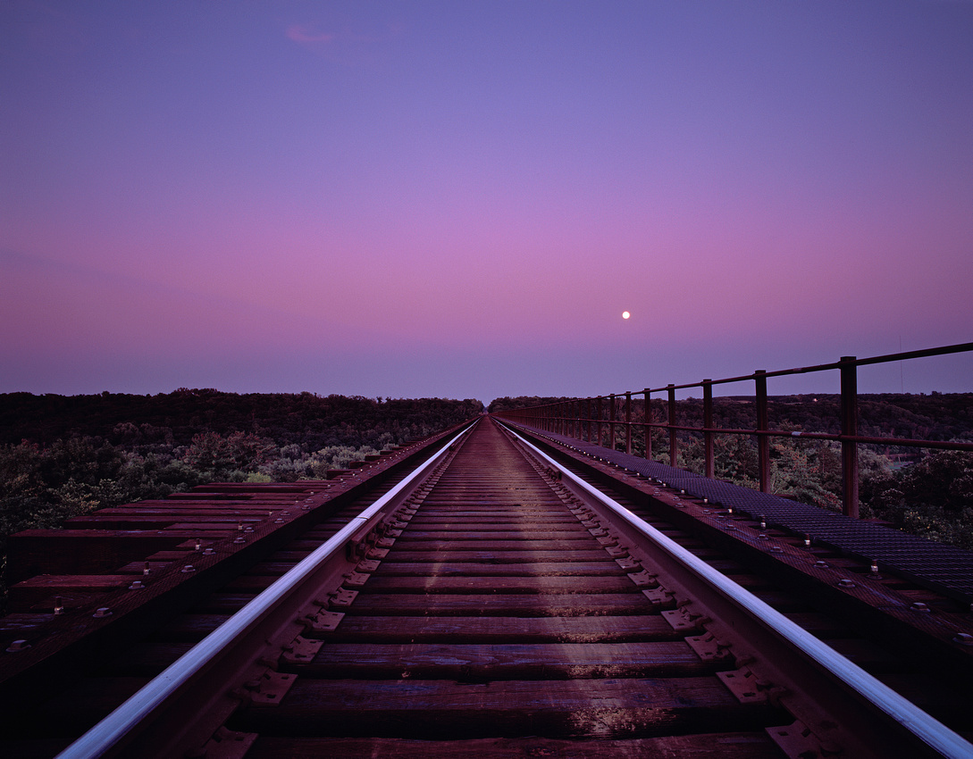
The Arcola Soo Line Bridge spans 2,682 feet and stands 184 feet above the St. Croix River, connecting Stillwater, Minnesota with Somerset, Wisconsin. Usually when I take a photograph, I drive up in my Jeep in good light, get out with my camera gear and set up - this has pretty much been my routine for years and I've been able to capture hundreds of beautiful scenes, but the Arcola Bridge required a different approach.

On a hot September afternoon I decided it was time to drive to Stillwater and capture the Arcola High Bridge the way I wanted to see it. A full moon was going to rise an hour before sunset and a windless, humid day meant that a haze in the air would create vibrant colors in the sky after sunset. I parked along Arcola Trail North and trekked northeast into the woods until I reached the bridge.

This bridge is alive, constly shifting and settling. I stood there on the tracks for any hour as the sun set and the moon rose higher into the eastern sky, leaving only after the last sign of civil twilight faded away.

Arcola Soo Line Bridge
Arcola Soo Line BridgeArcola Soo Line BridgeStillwater, Minnesota September 11, 2011

Washington County

Pentax 67 - Fuji Velvia RVP 50


Arcola Soo Line Bridge

]]>
[email protected] (Adam Johnson Minnesota Photography) Arcola Bridge Arcola Soo Line Bridge Arcola Soo Line High Bridge Railroad Bridge Soo Line High Bridge https://ajragno.zenfolio.com/blog/2013/3/arcola-soo-line-bridge Wed, 13 Mar 2013 06:05:13 GMT
Minnesota River Valley https://ajragno.zenfolio.com/blog/2013/3/minnesota-river-valley
Minnesota River
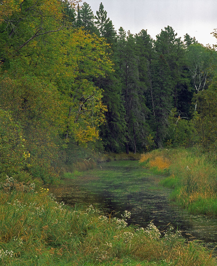
We had a very warm Fall in Minnesota and I took the opportunity to explore the Minnesota River Valley from Chaska to Henderson.

I'd been familiar with Henderson for years, but the Minnesota River Valley State Recreation Area in Chaska had remained a mystery to me until I one day looked at Google's satellite images and noticed cars parked off of Highway 41 south of Chaska. I went out and found that this is a part of the Minnesota State Park system and that it was set up for easy access to the river for hiking and fishing - and it's just 30 minutes from downtown Minneapolis.

Minnesota River
Minnesota River
Chaska Minnesota

]]>
[email protected] (Adam Johnson Minnesota Photography) Chaska Minnesota Minnesota River minnesota valley state recreation area https://ajragno.zenfolio.com/blog/2013/3/minnesota-river-valley Wed, 13 Mar 2013 00:54:37 GMT
Zippel Bay State Park https://ajragno.zenfolio.com/blog/2013/3/zippel-bay-state-park "Zippel Bay State Park"
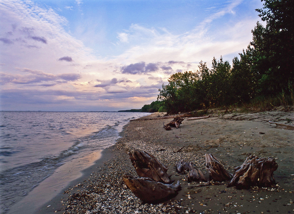
Zippel Bay State Park is located in far Northwestern Minnesota on the southern shores of Lake of the Woods. The 3,000 acre park offers sandy beaches, 6 miles of hiking trails and exceptional fishing opportunities. Unlike most of Minnesota's 58 State Parks, the 4 campgrounds at Zippel Bay do not have electrical hookups for the RV crowd, creating a much more rustic camping experience.

I first came to to the park by chance while on a trip across Northern Minnesota in 2009 and I've returned at least once a year ever since. This is the place to go when I want a solitary camping experience, so I feel a sense of personal betrayal when I say that this is Minnesota's best State Park.

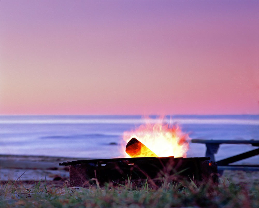
There are four distinct campgrounds here: The Angler's Campground, Ridge Campground, Birch Campground, and Lady Slipper Campground. There is also a swimming beach as well as a smaller beach reserved for those who are camping. This smaller beach even has a fire pit and picnic table. Though the lake is never what one would consider warm,  swimming can be enjoyable.

Blue Moon Zippel Bay State Park
Lake of the Woods Zippel Bay State Park
Zippel Bay State Park
Zippel Bay State Park Zippel Bay State ParkZippel Bay BeaconZippel Bay State Park

Lake of the Woods County

Zippel Bay State Park


]]>
[email protected] (Adam Johnson Minnesota Photography) Lake of the Woods Minnesota State Parks Zippel Bay State Park https://ajragno.zenfolio.com/blog/2013/3/zippel-bay-state-park Wed, 13 Mar 2013 00:48:28 GMT
Roseau County, Minnesota https://ajragno.zenfolio.com/blog/2013/3/roseau-county-minnesota Moonrise Roseau Minnesota

Roseau County was once covered by glacial Lake Agassiz. Most of the terrain is now vast farmlands, but Roseau County also contains Hayes Lake State Park, Lost River State Forest and also a significant portion of Beltrami Island State Forest. Because the area is so far away from most tourists destinations, there is not a lot of traffic to deal with and people you'll encounter tend to be out and about their daily lives.

The people of Roseau County are some of the most genuine that I have found in all of my travels. They are open, friendly and willing to help without hesitation. If you should visit, Roseau has hotels, grocery stores, mechanics and restaurants. Everything you need and more is right there. Camping at Hayes Lake State Park is also beyond comparison. It's a beautiful, well-run Park on the edge of Betrami Island State Forest.

Roseau MN
Wannaska
Roseau Minnesota
Broken ForestBroken Forest
Minnesota Sunflower Field
Minnesota Farmers
Lake Roseau Wildlife Management Area
Country Church
Withering Sunflowers
Wannaska Sunset
Pinecreek Minnesota
Beltrami Island State ForestBeltrami Island State Forest
Lost River State Forest
Moon Over Roseau
Roseau Wheat
Pinecreek Twilight

The Road To Happiness


]]>
[email protected] (Adam Johnson Minnesota Photography) Beltrami Island State Forest Roseau County Roseau Minnesota https://ajragno.zenfolio.com/blog/2013/3/roseau-county-minnesota Tue, 12 Mar 2013 23:09:41 GMT
Beltrami Island State Forest https://ajragno.zenfolio.com/blog/2013/3/beltrami-island-state-forest "Beltrami Island State Forest"

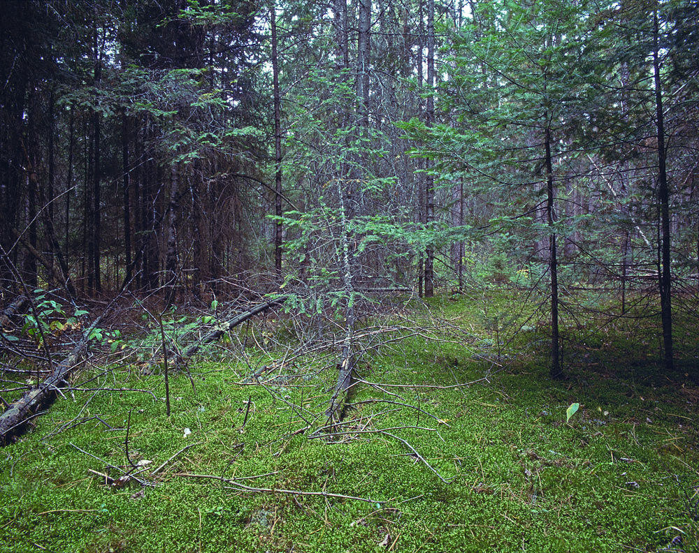
Minnesota has 58 state forests, most of which are located in the northern third of the state. What's unique about Beltrami Island State Forest is not only its size (it's our second largest state forest covering 703,366 acres) but also its living history, with an inherent sense sense of isolation while still remaining easily accessible from the North and West. You'll find miles and miles of gravel roads, making travel by car or truck relatively simple, as well unmarked logging trails that cut through the forest and offer some of the most pristine camping to be found in Minnesota. There are also three state-maintained rustic campgrounds and healthy wildlife population of black bear, porcupine and wolves. I heard wolves each night during my stay and saw a porcupine along Palsburg Forest Road that was so large that I initially thought it to be a bear cub.

Beltrami was settled in the early 1900s, but the sandy soil and lowland bogs proved unsuitable for farming and most of the homesteads were abandoned by 1940, since reclaimed by nature. The only remaining structures are the restored Winner Silo and Penturen Church. If you plan to visit, understand that there is no cell service and you're unlikely to meet anyone else out there with any predictability. On my last visit in late August 2012 I only encountered a few people even though I put over 500 miles on my Jeep throughout the forest's dusty roads. If you are not prepared it will be a very long wait or miles of walking in the event of a breakdown, so bring a map, compass and plenty of water, and keep in mind that ever year someone walks into these woods never to be seen again.

What brought me to Beltrami this year was the story of a lost hunter who'd chased a ruffed grouse into the woods near Penturen Church and didn't find his way out until the next day. I wanted to understand how someone familiar with the area could become so utterly lost in a matter of minutes. As a photographer, I wanted to see for myself and document what this vast and little-known forest has to offer in terms of scenery and wildlife. What I found was perfect solitude and an appreciation for what it must have taken for those who tried in vain to settle this land over 100 years ago.


Young PineYoung PineBeltrami Island State Forest

Lake of the Woods County


North Branch Rapid RiverNorth Branch Rapid RiverBeltrami Island State Forest

Lake of the Woods County


]]>
[email protected] (Adam Johnson Minnesota Photography) Beltrami Island State Forest Penturen Church https://ajragno.zenfolio.com/blog/2013/3/beltrami-island-state-forest Tue, 12 Mar 2013 20:53:07 GMT